...

By Tom Howarth
Science Reporter (Nature)
0
Share
Newsweek is a Trust Project member
See more of our trusted coverage when you search.Prefer Newsweek on Googleto see more of our trusted coverage when you search.
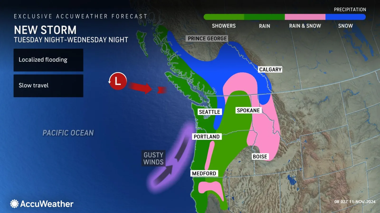
A matter of hours after one atmospheric river-fueled storm slammed into the Pacific Northwest, another is set to bring more widespread rain and snowfall, according to forecasters.
The first storm struck over the weekend and is expected to persist throughout Tuesday morning. By evening, the second storm will arrive, with effects expected to last through to Thursday.
"Enough moisture will linger in the Pacific Northwest for a couple of spotty showers [on Monday night] and Tuesday morning before the next storm system starts to bring back steadier rain again late Tuesday into Wednesday," Dave Houk, senior meteorologist at AccuWeather, told Newsweek.
Read More on U.S.
According to the National Weather Service (NWS), the atmospheric river will move inland, bringing coastal rain and mountain snow to northern California. Residents in the northern Rockies and Great Basin can expect a "wintry mix" through Wednesday.
...
The NWS is warning that locally heavy rainfall could bring isolated flooding to the Cascades, "expanding southward into coastal northern California."
Atmospheric rivers are weather systems that bring a stream of moisture up from the tropics in a concentrated, narrow band—literally like a river in the sky.
A typical atmospheric river carries a volume of water vapor comparable to the average flow at the mouth of the Mississippi River. However, powerful systems like this one can transport up to 15 times that amount, according to the NWS.
The first storm in the barrage was the most significant producer of precipitation of the season so far, with the next expected to be of similar magnitude, forecasters at AccuWeather said.
"Tuesday night through Wednesday, Seattle should pick up an inch to perhaps an inch and one half [of rainfall], while Portland should be around an inch," Houk said.
"Places along the coastal slopes, west side of the Olympic Mountains and west side of the Cascades will easily pick up 2-4 inches of rain with snow levels generally staying near or above 4,000 feet."

...
The worst-hit areas on the lower west-facing slopes of the Cascades, Coast Ranges, and the Olympics could see 4–8 inches of rain from Tuesday to Thursday.
Winds also pose a threat as the atmospheric river storm makes landfall. Gusts of up to 70 miles per hour are expected in some places.
Houk added, "Gusts over on the I-5 corridor, including Seattle and Portland could peak near 50 miles per hour during this time."
And that's not all. Yet another storm is forecast to hit the Northwest over the weekend, bringing colder air and more snow over the Cascade passes in Washington and Oregon.
Do you have a tip on a science story that Newsweek should be covering? Do you have a question about atmospheric rivers? Let us know via science@newsweek.com.
View 0 Comments
Submit Correction
View Editorial & AI Guidelines