...

By Joe Edwards
Reporter
0
Share
Newsweek is a Trust Project member
See more of our trusted coverage when you search.Prefer Newsweek on Googleto see more of our trusted coverage when you search.
An atmospheric river is set to strike this coming week, bringing the potential for heavy rain and snow to parts of the northwestern United States.
Why It Matters
Meteorologists warned that "widespread significant impacts" would be possible, including increased risk of flooding and rockslides.
Read More on News
What To Know
The National Weather Service (NWS) Weather Prediction Center said an atmospheric river is expected to arrive onshore Wednesday-Thursday, bringing with it heavy rain and snow to the Pacific Coast.
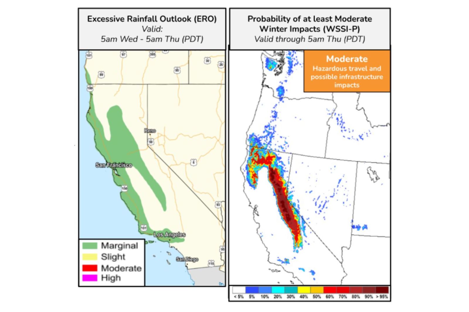
The weather service said on Saturday that heavy snow was likely to hit the Sierra Nevada and northern California terrain, though it was too soon to predict precise amounts. This, in combination with strong winds of 40 to 60 miles per hour, could lead to major impacts, the NWS said.
It warned that hazardous travel conditions were a possibility across many mountain passes.
...
Heavy rainfall, with rates exceeding 0.5 inches per hour, is expected, the NWS said.
This could lead to flash flooding, shallow debris flows over vulnerable burn scars, isolated rockslides, and hazardous travel conditions due slick roads.
Forecast maps from the agency showed that coastal California could see "excessive" rainfall, and there was a high chance of wintry impacts in the state's mountainous regions and the north.
Parts of Oregon and Washington could also see impacts, though this was less certain.
The National Oceanic and Atmospheric Administration (NOAA) defines atmospheric rivers as long, narrow corridors in the atmosphere that carry large amounts of water vapor.
While their size and intensity vary, they typically transport a volume of water vapor similar to the flow of the Mississippi River at its mouth.
In the case of exceptionally strong atmospheric rivers, this volume can be up to 15 times greater. Upon reaching land, they usually release their moisture in the form of rain or snow.
What People Are Saying
NWS Sacramento said on X, Saturday: "Although we have fairly quiet weather today, that is set to shift next week with Major Mountain Snow Travel Impacts expected and active weather throughout the week."
NWS Medford, Oregon, said on X: "Mild weather through early this week will give way to a colder, more unsettled pattern mid-late week with periods of strong winds, coastal/valley rain, and mountain snow. Expect at least moderate wind/winter impacts. Active weather likely continues into next weekend."
What Happens Next
The NWS Weather Prediction Center said the system is expected to track across the Great Basin, Central Rockies, and into the Northern Plains by the end of the week.
View 0 Comments
Submit Correction
View Editorial & AI Guidelines