...

By Jasmine Laws
Reporter
0
Share
Newsweek is a Trust Project member
See more of our trusted coverage when you search.Prefer Newsweek on Googleto see more of our trusted coverage when you search.
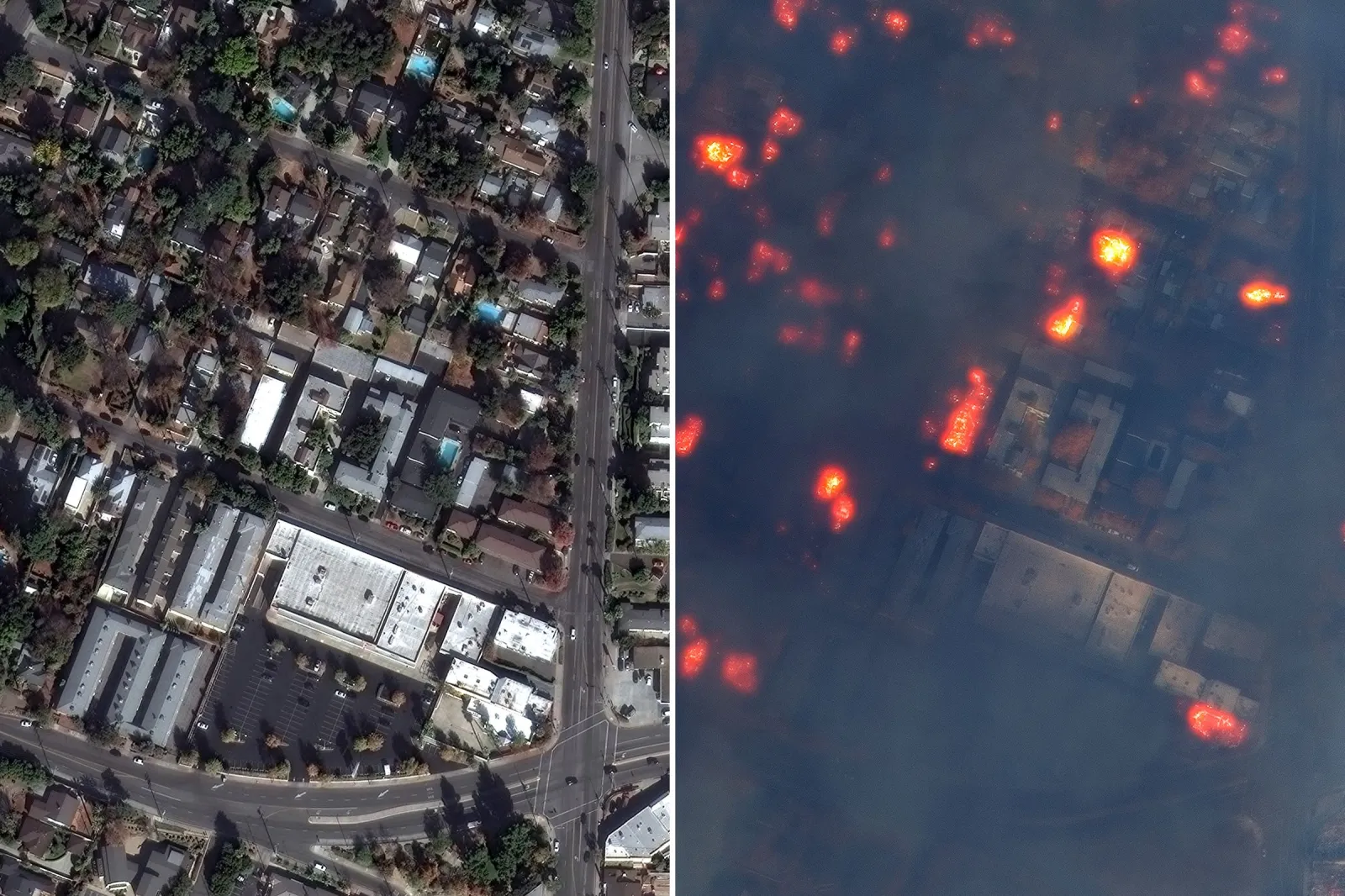
New satellite images from Maxar Technologies show the scale of the destruction and damage left so far by the wildfires raging in Southern California.
As of Wednesday afternoon, the Los Angeles Fire Department reported that the Palisades Fire had spread to 17,234 acres with 0 percent containment.
The Context
As the fire rapidly continues to spread, there are several reported injuries to both civilians and firefighters as well as significant destruction of infrastructure and homes. At least five people have been reported dead and 130,000 people are under evacuation orders, the Associated Press reported.
Read More on News
What To Know
The images shared with Newsweek by Maxar Technologies show the different areas in Southern California before and after the start of the fires.
In the first two images, the photos show houses that have been destroyed along the Pacific Coast Highway. A blaze of flames can be seen at a point on the coastline, as well as what appears to be a haze of smoke.
The second pair of images shows the damage to houses near Fair Oaks Avenue in Altadena. A number of the buildings can still be seen burning in the second photo and the darkened tint of the image could be due to the vast quantity of smoke created by the fire.
Another set of images shows the flames burning in East Altadena Drive, where again houses can be seen burning in the image taken on January 8, after the start of the fire.
The last pair of images shows a view of Marathon Road in Altadena, where smoke and patches of flames can be seen.
Images were also shared with Newsweek by Planet Lab which show the billowing smoke and scale of the Palisades and Eaton fires.
The Palisades fire was first reported at 10:30 a.m. local time on Tuesday and by 7:30 p.m. it had raged over more than 2,921 acres of land, according to California's Department of Forestry and Fire Protection (CAL FIRE).
Two other fires broke out later on Tuesday, the Eaton Fire in Altadena and the Hurst Fire in Sylmar.
The scale of the Eaton Fire has now reached more than 10,600 acres. The Hurst Fire has spread to 855 acres with 10 percent containment, per CAL FIRE.
On Wednesday afternoon two more fires broke out. One was in Hollywood Hills, the Sunset Fire, which has since spread to 60 acres, according to the Los Angeles Fire Department. The famous strip in West Hollywood, Sunset Boulevard, is in ruins from the flames, Los Angeles Times reported.
The second fire that started on Wednesday, the Lidia Fire, is in the mountainous Acton area north of Los Angeles and covered almost 350 acres. Authorities say it has been 40 percent contained.
What People Are Saying
Dr. Puneet Gupta, the assistant medical director for the Los Angeles County Fire Department, warned the AP: "We have a number of hospitals threatened, and if they have to be evacuated, it could become a crisis."
California Governor Gavin Newsom wrote on X (formerly Twitter): "To the heroes, firefighters, and first responders battling these fires in Los Angeles: Your sacrifice and determination inspire the entire state. California is deeply grateful for your dedication and service."
What's Next
According to California Governor Gavin Newsom, as of Wednesday night, more than 7,500 personnel have been deployed to tackle the spread of the fire, as well as 1,162 fire engines, 23 water tenders, 31 helicopters, 53 dozers, and six air tankers.
Update 01/10/25, 11:39 a.m. ET: This article has been updated with additional images shared with Newsweek by Planet Labs.
View 0 Comments
Submit Correction
View Editorial & AI Guidelines