...

By Anna Skinner
Associate News Editor
0
Share
Newsweek is a Trust Project member
See more of our trusted coverage when you search.Prefer Newsweek on Googleto see more of our trusted coverage when you search.
Drought conditions gripping Florida and much of the Southeast could heighten the dangers posed by hurricanes in the coming months, according to AccuWeather meteorologists, who warn that a dry start to the year does not necessarily mean a safer storm season.
The Atlantic hurricane season officially runs from June 1 through November 30, with activity typically peaking between August and October. Forecasters at the National Oceanic and Atmospheric Administration (NOAA) said the 2026 season is likely to be below average, predicting fewer storms than the long-term norm, largely because of the expected development of El Niño, which can suppress hurricane formation.
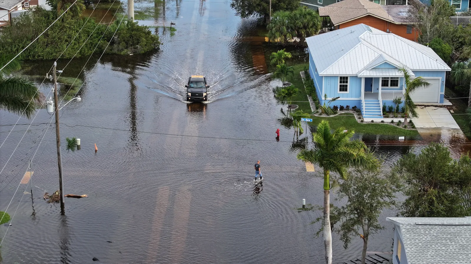
However, meteorologists consistently stress that a quieter season does not mean a safe one as even a single storm can have devastating consequences if it strengthens or makes landfall in a populated area. When coupled with significant drought across the Sunshine State, impacts could be even worse if a storm makes landfall.
Read More on Weather
...
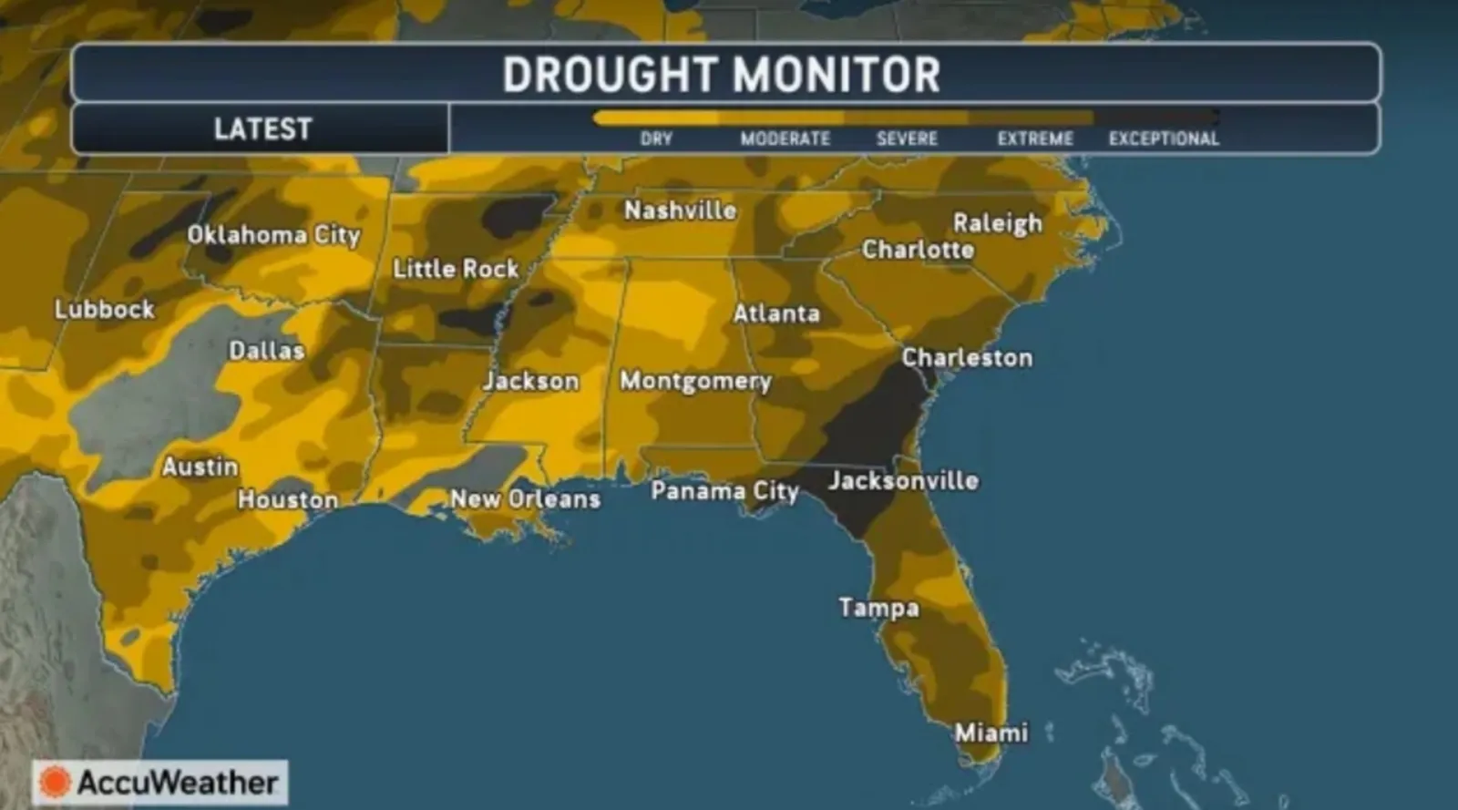
Recent data from the U.S. Drought Monitor shows that 64 percent of Florida and 56 percent of Georgia are experiencing extreme to exceptional drought, leaving landscapes parched, vegetation stressed and wildfire risks elevated. While the lack of rainfall may appear to reduce flooding concerns, experts say the opposite can be true when tropical systems arrive.
“Many people assume drought conditions lower the flood risk during hurricane season, but drought-hardened soil and wildfire burn scars can actually increase the risk of rapid runoff and flash flooding,” AccuWeather Lead Hurricane Expert Alex DaSilva told Newsweek. “Trees already weakened by drought stress or wildfire damage are more susceptible to falling during tropical storm and hurricane-force winds. The combination of drought-stressed trees and wildfire burn scars raises the risk of property damage from falling limbs, power outages, blocked roads, and flash flooding.”
Florida Drought Map as Warnings Issued
A drought monitor from AccuWeather shows that the worst drought is in Northern Florida and the Big Bend region.
Should a hurricane or tropical storm make landfall in that area, trees could be more vulnerable to strong winds and dangerous flooding could occur, as well as flash flooding.
...
In a separate report, AccuWeather said meteorologists are monitoring the Gulf for potential tropical storm development through June 11.
“While we always monitor the tropics for potential threats, we’ll be keeping a close eye on the central and eastern Gulf and the southwestern Atlantic,” DaSilva said in the report. “Climatologically, this region can experience early-season tropical development.”
The National Hurricane Center (NHC) is not expecting tropical activity in the Atlantic basin in the next seven days, according to its website.
How Super El Niño Impacts Hurricane Season
A strong or “super” El Niño event can play a major role in shaping hurricane activity, influencing both how many storms form and how intense they become. El Niño refers to a warming of ocean waters in the central and eastern Pacific, which alters atmospheric patterns across the globe. In the Atlantic basin, these changes often increase wind shear, or winds that disrupt developing storms, which potentially limits hurricane formation.
However, experts caution that El Niño does not eliminate risk. Even during strong El Niño years, destructive storms can still develop under the right conditions, particularly when local factors like warm Gulf waters and favorable atmospheric patterns align. In some cases, fewer storms may form overall, but those that do can still become powerful and cause widespread damage.
In Florida and across the Southeast, where drought has already weakened natural systems, even a limited number of storms could have outsized impacts. Combined with pre-existing dry conditions, a single slow-moving hurricane could trigger significant flooding, structural damage and widespread disruptions.
Meteorologists say one of the biggest concerns this season is how drought conditions affect the ground’s ability to absorb water. After extended dry periods, soil can become compacted and hardened, reducing its capacity to soak up rainfall. When heavy downpours arrive with a tropical storm or hurricane, water is more likely to run off quickly, increasing the risk of flash flooding.
The risk is compounded by wildfire burn scars, which are areas where vegetation has been stripped away by fire. Without plant life to help anchor soil and absorb moisture, these areas can channel water rapidly into streams and urban areas, raising the potential for sudden and dangerous flooding.
At the same time, drought-stressed trees and vegetation pose another hazard. Weakened by months of limited water, trees are more vulnerable to strong winds and can topple more easily during a storm. Falling branches and uprooted trees can damage homes, block roads and knock out power for extended periods.
What Happens Next as Atlantic Hurricane Season Looms
As the Atlantic hurricane season nears, forecasters are urging residents not to underestimate the risks posed by a storm, even if recent weather has been unusually dry. The combination of hardened ground, fire-damaged landscapes and weakened vegetation could turn what might otherwise be a manageable system into a far more dangerous event.
In a year marked by environmental extremes, meteorologists say preparedness remains key. People in living in coastal areas are urged to prepare before hurricane season begins, such as by making an emergency plan, stocking essential supplies and staying informed about weather alerts.
View 0 Comments
Submit Correction
View Editorial & AI Guidelines