...

By Amanda Greenwood
Associate News Editor
0
Share
Newsweek is a Trust Project member
See more of our trusted coverage when you search.Prefer Newsweek on Googleto see more of our trusted coverage when you search.
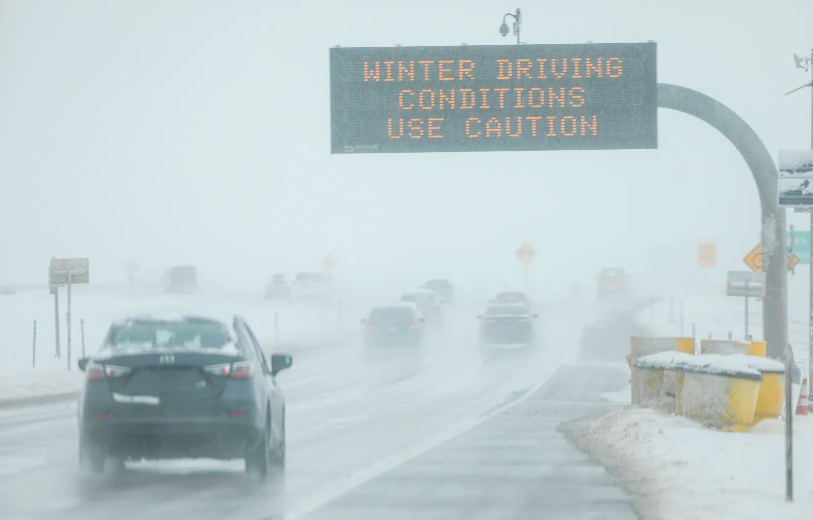
A powerful and unusually widespread late‑season winter storm is sweeping across parts of Colorado and Wyoming, prompting the National Weather Service (NWS) to issue multiple winter storm warnings and winter weather advisories, as up to 30 inches of snow is expected to hit various parts of the region through midweek.
NWS forecasters warn that the system could create "hazardous conditions" that are likely to disrupt travel, damage trees and power lines, and affect both busy urban corridors and remote mountain regions.
Snow Expected From the Plains to the Mountain Passes
In Colorado, winter weather advisories and winter storm warnings are in effect across much of the Front Range, Eastern Plains, central valleys and mountain regions from Tuesday evening through to Wednesday.
Read More on Weather
In higher elevations—including the Rocky Mountain National Park, the Indian Peaks, the Mosquito Range, Summit County and the Pikes Peak region—snowfall may be between 10 and 20 inches, with some locations potentially seeing up to 30 inches. This could make travel "very difficult to impossible," with conditions deteriorating rapidly along major mountain routes, such as Berthoud Pass, Cameron Pass, the Eisenhower Tunnel and Monument Hill.
...
Forecasters warn that the heavy, wet nature of the snow accumulating on branches and utility lines could lead to isolated or scattered power outages, especially from the northern Front Range foothills through the southern Front Range and into Teller and El Paso counties.
Along the Front Range urban corridor—including Denver, Boulder, Fort Collins and Castle Rock—snowfall totals are expected to be lower than in the mountains but still disruptive.
Between 4 and 8 inches of snow, with locally higher amounts near the foothills and along the Palmer Divide, could result in slick and hazardous roads. Officials say the impacts are most likely during the Tuesday evening commute and the Wednesday morning commute, when snowfall rates and temperatures are expected to be most favorable for snow accumulation.
Lower‑elevation areas—including parts of Weld, Adams, Arapahoe, Elbert, Park and Grand counties—are forecast to receive 3 to 7 inches of snow, with heavier pockets possible in Park County.
Mountain locations outside the Front Range are also expected to see significant snowfall. Parts of Rabbit Ears Pass, the Sawatch Range, the Sangre de Cristo Mountains and the Wet Mountains could receive 6 to 14 inches of snow, with wind gusts reaching 35 to 40 mph in some areas. These conditions may lead to blowing snow, reduced visibility and hazardous travel across high‑elevation passes.
Wyoming Also Severely Affected
In Wyoming, winter weather advisories and warnings are in effect across much of the state's mountain ranges and surrounding valleys, including the Snowy Range, Laramie Range, Sierra Madre Range, and parts of central and southeastern Wyoming.
The winter storm is expected to bring significant travel and safety impacts, particularly overnight on Monday through to Wednesday morning, as heavy snow spreads across mountain terrain, foothills, and nearby towns and cities.
In the Snowy Range, snowfall totals of 10 to 18 inches—especially above 9,000 feet and on the northern and eastern slopes—could make conditions dangerous for anyone caught outdoors. The NWS warns that falling and blowing snow could sharply reduce visibility, increasing the risk for hunters, hikers and snowmobilers to become disoriented or lost in backcountry areas.
Along Interstate 80, impacts are expected to be especially severe. The north Snowy Range foothills—including Arlington and Elk Mountain, as well as the south Laramie Range and foothills near the I‑80 summit between Cheyenne and Laramie—are forecast to receive between 5 and 17 inches of heavy snow. Roads, bridges and overpasses are likely to become slick, slushy and hazardous, potentially leading to travel delays or temporary closures.
In central Laramie County, including Cheyenne, snowfall totals of up to 10 inches could lead to sporadic power outages, and travel conditions could become difficult, particularly during early morning and evening commute hours.
Snow Warnings: What Should Drivers Expect on I‑25 and I‑70
Major travel corridors along Interstate 25 and Interstate 70 are expected to face some of the most disruptive impacts from the storm, particularly as heavy snowfall intensifies from Tuesday evening into Wednesday morning.
Along I‑25, the NWS warns that periods of heavy, wet snow could lead to rapidly deteriorating road conditions across the Front Range urban corridor, including stretches through Denver, Castle Rock, Colorado Springs and Monument Hill. While widespread full closures have not been preannounced, officials say temporary closures, traction laws and accident‑related shutdowns are possible, especially during peak commute hours when snowfall rates may outpace plowing operations.
The Palmer Divide and Monument Hill are of particular concern for I‑25 travelers, as these elevated sections tend to accumulate snow more quickly and are prone to sudden visibility drops. Denver7 reports that conditions could shift from wet roads to snow‑covered pavement in a short time frame, increasing the risk of spinouts and traffic delays during the Wednesday morning commute.
On I‑70, impacts are expected to be more severe and longer‑lasting, especially west of Denver through the high country. The NWS warns that heavy snowfall combined with gusty winds could produce near‑whiteout conditions across major mountain travel segments, including the Eisenhower‑Johnson Memorial Tunnel, Vail Pass, Berthoud Pass and approaches to the Continental Divide. These conditions heighten the likelihood of chain requirements, metered traffic flow and safety‑related closures, particularly overnight and early on Wednesday.
Transportation officials advise drivers using either interstate to delay nonessential travel, monitor real‑time road conditions and prepare for sudden slowdowns or stoppages if crashes or heavy snow bands develop.
How Much Snow Is Expected? Colorado and Wyoming Snow Totals Forecast

...
Snowfall totals from this system are expected to vary sharply by elevation, with mountain and foothill areas bearing the brunt of accumulation.
In Colorado, NWS winter storm warnings outline 10 to 20 inches of snow across many high‑elevation areas—including Rocky Mountain National Park, the Indian Peaks, Summit County, the Mosquito Range and the Pikes Peak region—with isolated totals approaching 30 inches in the most favored terrain. These heavier amounts are expected to fall primarily from late Tuesday through early Wednesday.
Across the Front Range urban corridor—including Denver, Boulder, Fort Collins and Castle Rock—forecasters expect 4 to 8 inches of snow, with locally higher totals near the foothills and along the Palmer Divide. While lower than mountain totals, this accumulation is expected to coincide with commute periods, increasing the likelihood of travel disruptions and minor infrastructure impacts.
Lower‑elevation plains in Colorado are forecast to receive 3 to 7 inches, while additional mountain regions outside the Front Range—such as Rabbit Ears Pass, the Sawatch Range, the Sangre de Cristo Mountains and the Wet Mountains—could see 6 to 14 inches, accompanied by gusty winds that may reduce visibility.
In Wyoming, winter storm warnings cover multiple mountain ranges and surrounding valleys, with 10 to 18 inches expected in the Snowy Range and 5 to 17 inches possible near high‑impact transportation corridors, including areas around Interstate 80 between Cheyenne and Laramie. These accumulations are likely to create prolonged hazardous travel conditions through midweek.
How To Prepare Before the Storm Hits
The NWS is advising residents in affected areas to start preparing for severe winter weather conditions now:
- Continuously check local forecasts and road conditions, particularly before travel.
- Make sure that vehicles are winter‑ready, with good tires and extra supplies of fuel and windshield fluid.
- Pack an emergency travel kit with shovels, nonperishable food, drinking water, blankets, flashlights (with spare batteries) and a phone charger.
What To Do During Winter Weather
During periods of heavy snow, the NWS suggests that people consider the following:
- Avoid unnecessary travel, especially overnight and during peak commute hours.
- If they must travel, reduce speed and increase the distance between the car in front.
- Use extra caution over bridges, mountain passes and shaded roads, as they could be extra slippery.
- Stay indoors if conditions deteriorate, and be prepared for possible power outages.
While the storm reflects this winter's lingering grip, preparation could mean the difference between a manageable disruption and a serious hazard as the system continues through the week.
View 0 Comments
Submit Correction
View Editorial & AI Guidelines