...


By Amanda Greenwood and Anna Skinner
0
Share
Newsweek is a Trust Project member
See more of our trusted coverage when you search.Prefer Newsweek on Googleto see more of our trusted coverage when you search.
Residents across three states have been told to brace themselves for heavy snow (up to 18 inches) and strong winds (reaching 90 mph), which are expected to strike from Monday or Tuesday, lasting, in some cases, until Wednesday, according to the National Weather Service (NWS).
The forecast "hazardous conditions" are likely to make travel "very difficult to impossible," the NWS says, prompting it to advise some people in affected areas to "delay all travel."
States Affected By Heavy Snow and Strong Winds
Parts of California and Nevada are under winter storm watches, meaning that there’s a chance they could experience extreme winter storm conditions within the next 48 hours.
Read More on Weather
Certain places in Alaska have been issued winter storm warnings, which means a "significant combination of hazardous winter weather is occurring or is imminent," according to the NWS.
...
California
On Monday morning, California's winter storm watch was upgraded to a winter storm warning, although the forecasted snowfall totals remained the same.
The Kaiser to Rodgers Ridge, the upper side of the San Joaquin River, and the Kings Canyon, Sequoia, and Yosemite National Parks are forecast to get between 12 and 18 inches of snow in the highest areas, and 75 mph winds—particularly along the Sierra Crest—from Monday night until Wednesday afternoon. The NWS has warned that visibility might drop below a quarter of a mile at times because of blowing snow.
Mono County is also expected to get up to 18 inches of snow along the highest peaks, but from Tuesday morning through to Wednesday afternoon. Lesser amounts—between 6 and 12 inches—are expected in areas above 8,000 feet, and up to 4 inches is likely along Highway 395. Winds could get up to 80 mph along the higher ridges.
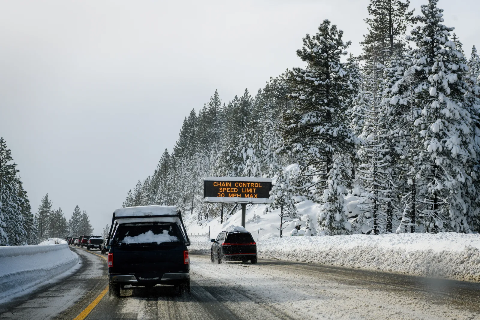
The Sierra Nevada and the southern Cascades—including Highway 50, Interstate 80, and Lassen National Park—could see between 12 and 18 inches of snow in areas above 5,000 feet, and up to 2 feet across the highest peaks from Monday evening until Wednesday afternoon, along with 50 mph winds.
From Tuesday morning, Markleeville in Alpine County, Tahoe City in Placer County, South Lake Tahoe in El Dorado County, and Truckee in Nevada County could get up to 4 inches of snow in areas situated at lake level—particularly along the western shoreline—but up to 10 inches is forecast for areas above 6,500 feet, and up to 18 inches is possible along the highest peaks. The NWS has warned that 90 mph "ridgetop" winds could also blast affected areas. These conditions are likely to last until Wednesday afternoon.
Nevada
Parts of the Greater Lake Tahoe area on the Nevada side—including Glenbrook and Stateline in Douglas County and Incline Village in Washoe County—could get between 4 and 18 inches of snow along the highest ridgetops, along with winds reaching up to 90 mph, from Tuesday until Wednesday afternoon.
In addition to the possible snowfall, a high wind watch and a high wind warning are in effect for southern Nevada. Strong winds associated with the winter storm will blow into Nevada on Tuesday, possibly contributing to widespread power outages, NWS meteorologist Jenn Soulat told Newsweek.
Alaska
The eastern Norton Sound and Nulato Hills could get up to 4 inches of snow and gusty 30-mph winds, lasting until mid-Monday morning. Falling and blowing snow is likely to reduce visibility to less than half a mile at times, which could make travel in these areas difficult, the NWS warns.
The middle parts of the Yukon Valley may get up to 8 inches of snow, and the lower parts of the Yukon and Innoko Valleys, along with the upper parts of the Kuskokwim Valley, could see up to 5 inches of snow and 30 mph winds, lasting until Monday afternoon.
Between 4 and 12 inches of snow and 40 mph winds are forecast to blast the eastern Alaska Range, south of Trims Camp, until Monday afternoon.
Winter Storm Watch vs. Winter Storm Warning
A Winter Storm Watch is issued when conditions are favorable for a significant winter storm, but key details such as exact timing, track and severity remain uncertain. Watches are typically posted 24 to 48 hours in advance and alert residents to the potential for hazardous conditions such as heavy snow, sleet or damaging ice.
A Winter Storm Warning, by contrast, signals a higher level of confidence that dangerous winter weather is imminent or already occurring. Issued when warning criteria are expected to be met, a warning means heavy snow or ice is likely to significantly impact travel and daily activities, with conditions that could become dangerous or life-threatening.
Update 4/20/26, 4:36 p.m. ET: This article was updated to include additional information.
View 0 Comments
Submit Correction
View Editorial & AI Guidelines