...

By Flynn Nicholls
US News Reporter
0
Share
Newsweek is a Trust Project member
See more of our trusted coverage when you search.Prefer Newsweek on Googleto see more of our trusted coverage when you search.
Hurricane Milton continues to threaten Florida's Gulf Coast, with the Category 5 storm now expected to make landfall at Sarasota, just south of Tampa Bay.
As of 2 a.m. Wednesday ET, the National Hurricane Centre (NHC) reported that Milton has sustained wind speeds of 160 mph as it moves northeastward at 12 mph.
It was previously forecast to make landfall near Tampa, but the latest models have it making landfall near Sarasota.
Read More on News
More From Newsweek Vault: What Is an Emergency Fund?
Where Will Hurricane Milton Make Landfall?
In an update Monday at 5 a.m., the NHC predicted that Milton's eye would be over central Florida around 2 a.m. Thursday, meaning that it would make landfall near Tampa sometime Wednesday evening.
Later that same day, in an update published at 11 p.m., forecasters said that Milton could hit around 8 p.m. Wednesday.
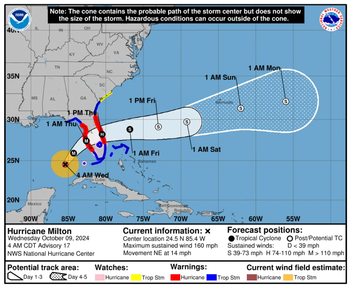
The current NHC forecast has the center of the storm just off Florida's west coast at 7 p.m. Wednesday, and directly over central Florida at 7 a.m. Thursday.
More From Newsweek Vault: 5 Steps to Build an Emergency Fund Today
But in a Tuesday briefing, Florida Governor Ron DeSantis warned residents that the impacts would be far broader than the direct landfall area.
"I would just tell people, one, we're going to have impacts far beyond wherever the eye of the storm is. Two, you can make landfall anywhere from Citrus County down into Southwest Florida. We'll know more over the next 12 to 18 hours. But just, cones, all this stuff you see, the impacts will be broader than that, specifically with respect to storm surge."
Meteorologist Bryan Bennett said the storm landing at Sarasota rather than downtown Tampa would have "massive implications" on the surge forecast.
More From Newsweek Vault: Online Banks vs. Traditional Banks: Learn the Differences
"Not only could Tampa Bay not have a massive storm surge, but it could actually go negative, slightly draining like Tampa Bay did with Ian. Not good for Sarasota, Siesta Key, Venice, & Englewood with 10 foot or greater storm surge," he wrote on X Tuesday evening. "Potentially some good news this evening for the Bay (downtown Tampa, downtown St. Pete, St. Pete Beach, Clearwater) But, a shift of 25 miles farther north & we are talking a 16 ft difference in places like downtown Tampa."
Hurricane Milton's Projected Path
The NHC has been tracking Milton's path for several days. It is currently forecast to remain a hurricane as it crosses the central Florida peninsula on Thursday, before moving east into the Atlantic Ocean north of the Bahamas.
...
A storm surge warning is in place for Florida's west coast from Flamingo northward to Yankeetown, including Charlotte Harbor and Tampa Bay, and on the Atlantic coast from Sebastian Inlet Florida to Altamaha Sound Georgia, including the St. Johns River. Storm surges of more than 10 feet are expected in some areas.
A Hurricane Warning is in effect for Florida's west coast from Bonita Beach northward to Suwannee River, including Tampa Bay, and on the Atlantic coast from the St. Lucie/Martin County Line north to Ponte Vedra Beach.
A map from the NHC shows the storm surge warnings in place.

...
The storm could make landfall as early as Wednesday afternoon, but the expected timeline has been pushed back to the evening.
Hurricane Milton Evacuation Map
Mandatory evacuation orders have been issued for more than a dozen counties and voluntary evacuations have been issued in more. DeSantis issued emergency orders over the weekend that now include 51 counties. He urged residents to follow these orders and prepare for potentially historic impacts.
Evacuations are particularly important along Florida's west-central coast, where storm surges could more than 10 feet in some areas.
An interactive map compiled by floridadisaster.org shows the specific evacuation orders in place for each county.
View 0 Comments
Submit Correction
View Editorial & AI Guidelines