Getty Images/National Weather Service

By Anna Skinner
Associate News Editor
0
Share
Newsweek is a Trust Project member
See more of our trusted coverage when you search.Prefer Newsweek on Googleto see more of our trusted coverage when you search.
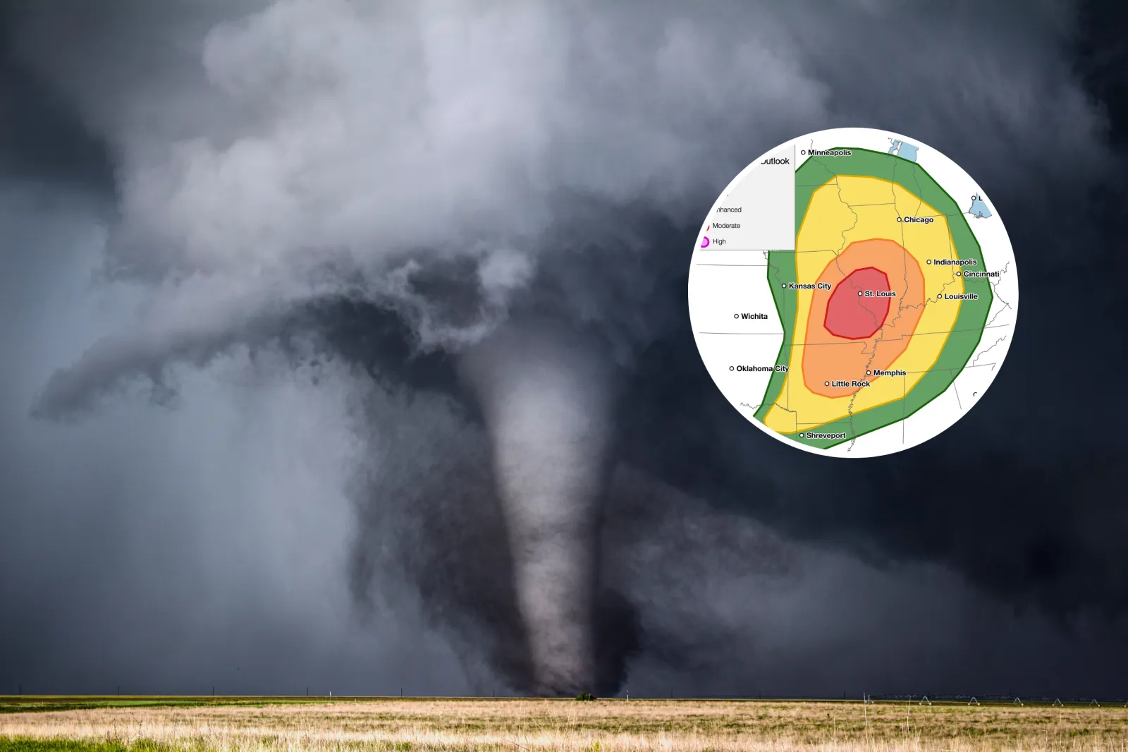
The National Weather Service (NWS) is warning of a potentially dangerous severe weather setup across parts of the Midwest on Monday, issuing an updated tornado threat map that highlights an “intense” risk level for the region.
In a post shared by the NWS on X, forecasters emphasized the potential for powerful storms capable of producing strong to intense tornadoes as conditions come together over the central part of the country.
Areas of highest risk include southwestern Illinois and eastern Missouri, including St. Louis, putting hundreds of thousands at risk.
Read More on Weather
The risk designation reflects a combination of atmospheric ingredients that can support rotating supercell thunderstorms, along with damaging winds and large hail. Officials urged people to closely monitor forecasts, have multiple ways to receive warnings, and be ready to take shelter quickly if severe weather develops.
"A strong storm system will approach the mid Mississippi Valley today, bringing multiple rounds of severe storms this morning and again this afternoon/evening," NWS posted on X with a map of the risk area. "A threat for multiple strong to intense tornadoes will be likely this afternoon/evening."
The NWS stressed timing and exact impacts could change as storms evolve, but the threat is serious enough to warrant heightened awareness. Additional alerts and warnings are expected to be issued as the situation unfolds across the Midwest.
The NWS was scheduled to go live on YouTube as 1 p.m. Eastern time (ET) to address the storm threat. The footage can be watched below.
Thousands Without Power in Illinois After Severe Storms
As of around 2:15 p.m. ET, more than 13,000 people in Illinois were reporting power outages, according to poweroutage.us. The outages occurred after a line of severe thunderstorms moved through the area.
The highest percentage of power outages per county population was being reported in Pike County in western Illinois.
New Tornado Watches Issued for Missouri, Illinois
Widespread tornado watches encompassed much of Missouri and southern Illinois on Monday afternoon as NWS meteorologists warned of an increasing chance of tornadoes within the watch area. The tornado watch will remain in place until 9 p.m. local time for the following counties:
- Missouri: Benton, Callaway, Camden, Christian, Cole, Crawford, Dallas, Dent, Douglas, Franklin, Gasconade, Greene, Hickory, Howell, Iron, Jefferson, Laclede, Lincoln, Madison, Maries, Miller, Moniteau, Montgomery, Morgan, Oregon, Osage, Ozark, Perry, Phelps, Polk, Pulaski, Reynolds, Shannon, St. Charles, St. Francois, St. Louis, Ste. Genevieve, Taney, Texas, Warren, Washington, Webster, Wright.
- Illinois: Bond, Calhoun, Clay, Clinton, Crawford, Edwards, Effingham, Fayette, Franklin, Hamilton, Jackson, Jasper, Jefferson, Jersey, Lawrence, Macoupin, Madison, Marion, Monroe, Montgomery, Perry, Randolph, Richland, St. Clair, Washington, Wayne, White.
Tornado Warning Issued as Storm Threat Ramps Up
At 11:20 a.m. Central time (CT), the NWS office in Lincoln, Illinois, issued an urgent tornado warning for southeastern Christian County, central Moultrie County, and central Shelby County after radar indicated rotation within a severe thunderstorm near Findlay.
The development prompted urgent warnings for people within the storm's path.
"TAKE COVER NOW! Move to a basement or an interior room on the lowest floor of a sturdy building," the warning said. "Avoid windows. If you are outdoors, in a mobile home, or in a vehicle, move to the closest substantial shelter and protect yourself from flying debris."
The storm was expected to reach Findlay around 11:25 a.m. CT, Sullivan around 11:35 a.m. CT, and Allenville around 11:40 a.m. CT.
Severe thunderstorm watches spanned hundreds of miles, stretching from western Illinois through central Indiana and into northwestern Kentucky.
...
Cities at Greatest Risk
A field weather reporter for The Weather Channel warned several well-populated areas were at a critical risk on Monday.
They include St. Louis, Missouri; Quincy, Illinois; and Paducah, Kentucky.
"URGENT UPDATE: TORNADO WARNINGS ALREADY ACTIVE The threat today is escalating quickly," Charles Peek posted on X on Monday. "We are already seeing Tornado Warnings in progress this morning as the first round of storms pushes through. This is a fast-evolving situation, and the risk is starting earlier than anticipated. Today, April 27, marks the peak of this dangerous multi-day severe weather stretch. The ingredients for significant, long-track tornadoes are coming together right now."
View 0 Comments
Submit Correction
View Editorial & AI Guidelines