...

By Joe Edwards
Reporter
0
Share
Newsweek is a Trust Project member
See more of our trusted coverage when you search.Prefer Newsweek on Googleto see more of our trusted coverage when you search.
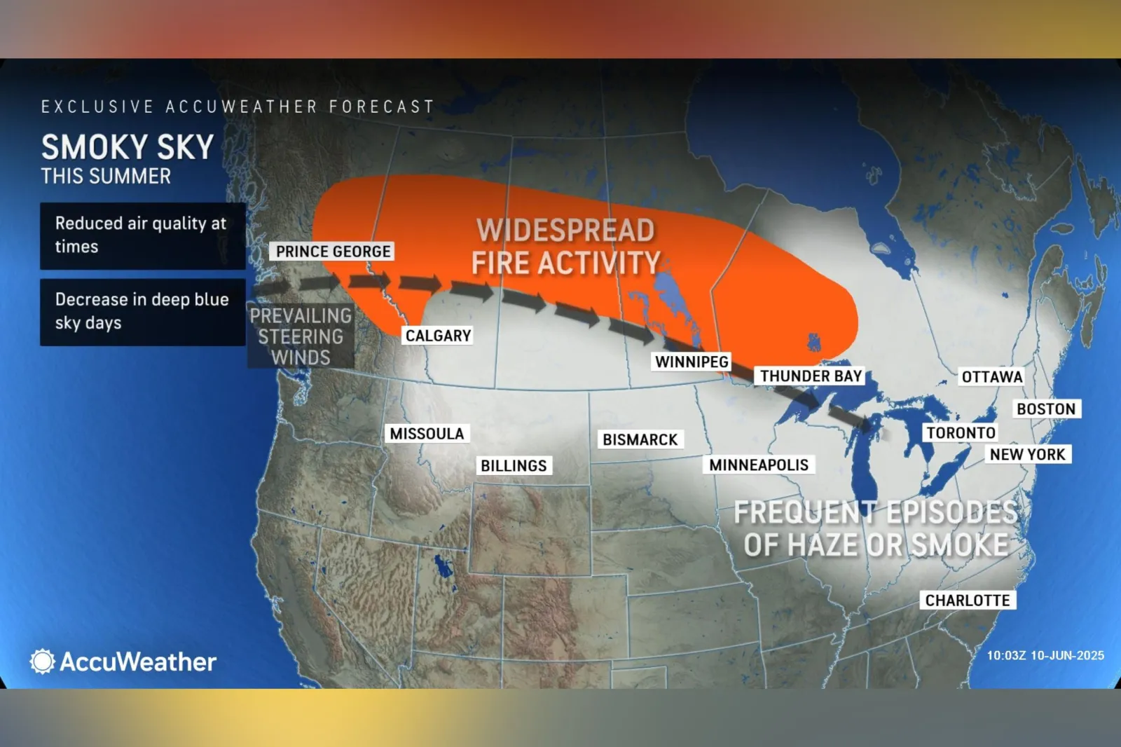
Millions of Americans across the northern U.S. were expected to experience frequent episodes of hazy, milky skies throughout the summer of 2025 as smoke plumes drift south from Canadian wildfires, according to AccuWeather meteorologists.
Why It Matters
Areas under the thickest smoke risk periods of reduced air quality, AccuWeather said.
Read More on News
According to research published by the National Library of Medicine, consistent evidence links wildfire smoke exposure to acute respiratory issues, including infections and flare-ups of existing asthma and chronic obstructive pulmonary disease.
What To Know
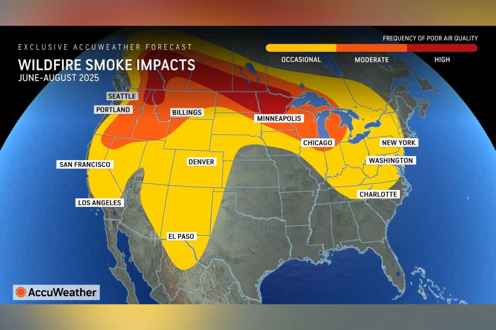
Areas from Washington, Idaho, and Montana, extending eastward into North Dakota, Wisconsin, and Minnesota, were identified as likely to face high frequencies of wildfire smoke.
The area experiencing a moderate frequency of wildfire smoke encompassed the northern U.S. border and reached into the Great Lakes region, including Chicago.
AccuWeather's forecast map showed that even states as far south as Texas and New Mexico would experience occasional wildfire smoke impacts from June through August.
...
In the east, states including Tennessee, North Carolina, West Virginia, New Jersey, and New York could also see occasional impacts.
AccuWeather meteorologist Brandon Buckingham explained that on sunny days—particularly during stretches of calm, clear weather—sunlight can break down smoke and haze in the atmosphere, causing it to sink towards the surface and increasing the likelihood of ozone action days or air quality alerts.
...
What People Are Saying
AccuWeather meteorologist Brandon Buckingham said, in an advisory shared with Newsweek: "Another southward press of Canadian wildfire smoke is underway, blanketing the sky with hazy conditions across the northern Plains, Midwest and Northeast once again this week.
"Some good news is on the way later this week in Canada, where a majority of the active fires are burning, as a storm is expected to sweep through and bring beneficial rain across the western and central provinces between Friday and Sunday. The return of rain across the region can temporarily slow the rate of wildfire spread in the region and, in some cases, may be able to put some fires out.
"The pattern change this week may be able to temporarily mitigate the concerns for expansive wildfire smoke intrusions heading into the latter half of June, but above-average warmth and a general continuation of below-average rainfall is expected this summer, which will further increase the risk for a smoke and haze filled sky at times throughout the summer season in the northern and eastern United States."
What Happens Next
According to AccuWeather experts, clear, hazeless blue skies may remain uncommon across the Midwest and Northeast until mid-summer, as Canadian wildfires continue to burn.
The outlet predicts that this year in the U.S., between seven million and nine million acres of land will burn, which would be above the historical average.
View 0 Comments
Submit Correction
View Editorial & AI Guidelines