Gary Hershorn/WPC/Getty Images

By Joe Edwards
Reporter
0
Share
Newsweek is a Trust Project member
See more of our trusted coverage when you search.Prefer Newsweek on Googleto see more of our trusted coverage when you search.
Parts of the Northeast and Great Lakes region are facing an “impactful” post-Christmas winter storm, with forecasters warning of “treacherous” travel conditions following the holiday.
In an early morning update on Friday, the National Weather Service Weather Prediction Center (WPC) said that a wintry mix of freezing rain and sleet will make travel hazardous across the Great Lakes, north-central Appalachians and much of the Mid-Atlantic through Saturday morning.
Freezing rain totals over a quarter of an inch are forecast from northwest Pennsylvania to western Maryland, with tree damage and power outages possible. A mix of sleet and freezing rain is also likely from central Pennsylvania through the D.C./Baltimore and Philadelphia metro areas, according to the agency.
Read More on News
Heavy snow is likely from central New York through northeast Pennsylvania and the Tri-State area, the WPC also said.
“This winter storm is likely to generate treacherous travel conditions and delays following Christmas Day,” it cautioned.
“In the East, the snow and ice storm is underway across the Great Lakes as of early Friday morning, and will continue to spread across the eastern Great Lakes, the Northeast and portions of the mid-Atlantic between Friday and Friday night,” AccuWeather meteorologist Brandon Buckingham told Newsweek.
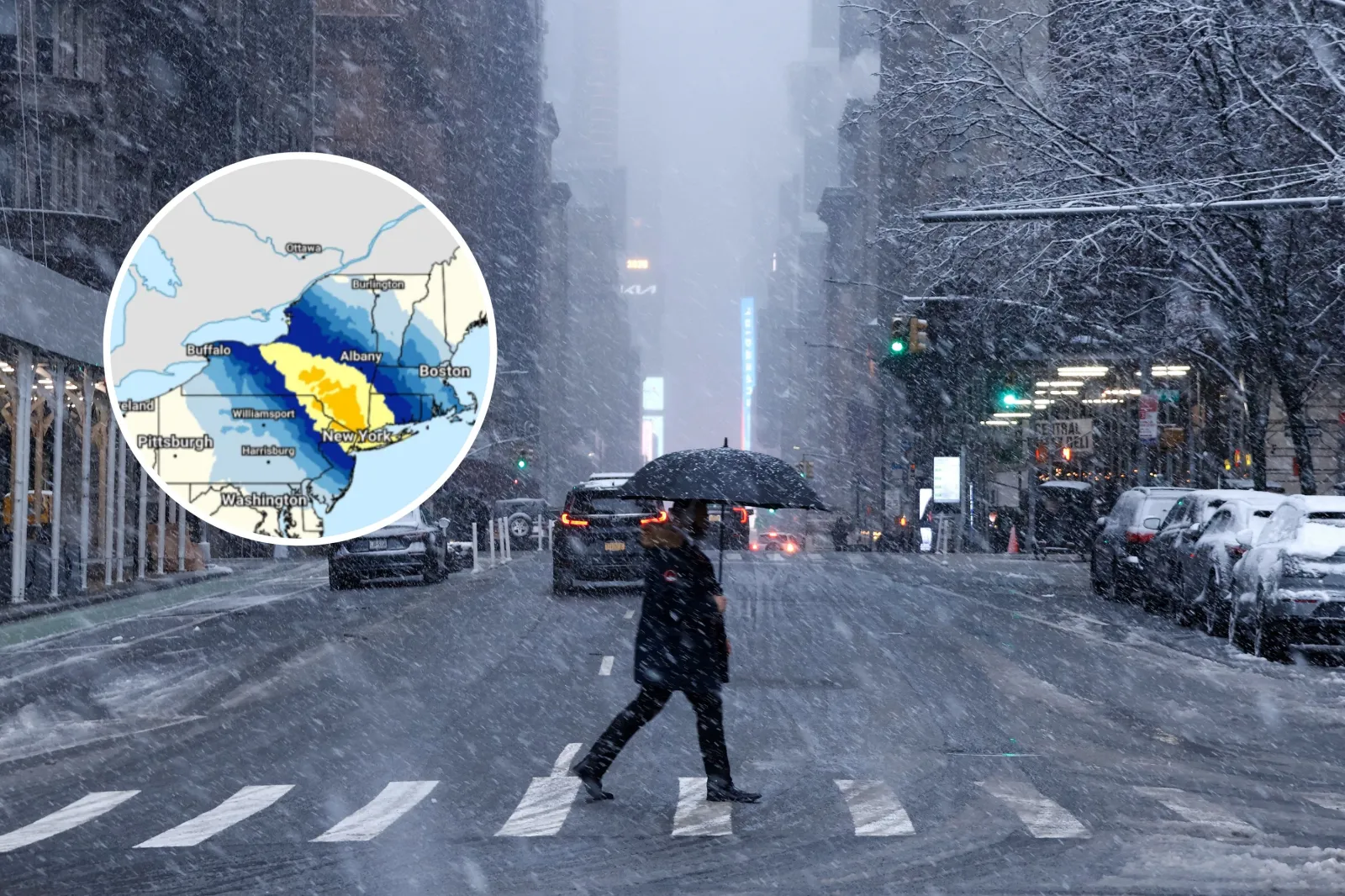
The heaviest snowfall is forecast across much of upstate New York and into the Hudson Valley, Buckingham said. New York City is expected to receive 3 to 6 inches from this system, with precipitation beginning around or just after sunset Friday. Snow is then likely to persist in the city through Saturday morning before ending, according to the meteorologist.
“If precipitation falls as all snow in New York City, snowfall totals could end up near the higher end of the expected range, and conversely, if sleet or rain mix in for a time, snowfall totals can end up on the lower end of the expected range,” Buckingham said.
A band of freezing rain is also developing with this system and is expected to create travel hazards across lower Michigan, southern Ontario in Canada and far northern Ohio, as well as much of Pennsylvania and parts of Maryland, Delaware and the Virginias, said Buckingham.
“The highest ice accretion is expected to occur in southeast Michigan and west-central Pennsylvania, where localized amounts of 0.25-0.5 inches of freezing rain can occur.
“For all areas in the path of this storm, conditions will improve from west to east from the Great Lakes to the East Coast between Friday night and early afternoon on Saturday,” Buckingham added.
Winter storm warnings and winter weather advisories from the National Weather Service span swathes of the Great Lakes and Northeast as of Friday morning, including but not limited to portions of Minnesota, Wisconsin, Michigan, Ohio, Pennsylvania, New York, and Maryland.
Gary Hershorn/WPC/Getty Images
Stock image of a person crossing a road in snowy weather. Inset: Map of the area of the U.S. being affected by a post-Christmas storm.
View 0 Comments
Submit Correction
View Editorial & AI Guidelines