
SPC

By Joe Edwards
Reporter
0
Share
Newsweek is a Trust Project member
See more of our trusted coverage when you search.Prefer Newsweek on Googleto see more of our trusted coverage when you search.
Forecasters are warning that stretches of the U.S. could see multiple days of severe storms in the week ahead.
“Severe Weather and a several day stretch starts today across portions of the southern and central U.S.,” the National Weather Service (NWS) said in a Wednesday update.
“Chances for damaging winds and hail, and tornadoes peak on Friday with an Enhanced Risk (level 3 out of 5), but all hazards look possible each day for the next week.”
Read More on News
In a Thursday forecast discussion, the Weather Prediction Center (WPC) said that severe thunderstorms are expected for parts of the southern to central Plains Thursday, spreading eastward into parts of the Midwest on Friday.
“Ongoing showers and thunderstorms over the Red River Valley into the Ohio Valley early Thursday morning will begin to wind down through this afternoon but new thunderstorm development ahead of a dryline is expected by this evening over Texas into Oklahoma,” the agency said. “These storms will have the potential to be severe with the activity spreading north and east through Oklahoma into parts of Kansas tonight.”
For Friday, the NWS said severe storms, with large hail, strong wind gusts, and even tornados are expected.
The southern and central plains into the lower to mid-Missouri Valley are under threat Friday afternoon, while threats will linger in the evening into the overnight hours for the Mid- to Upper Mississippi Valley, according to the agency.
“Approaching severe weather will be difficult to see,” with the storms anticipated to persist through the overnight hours, the NWS cautioned.

...
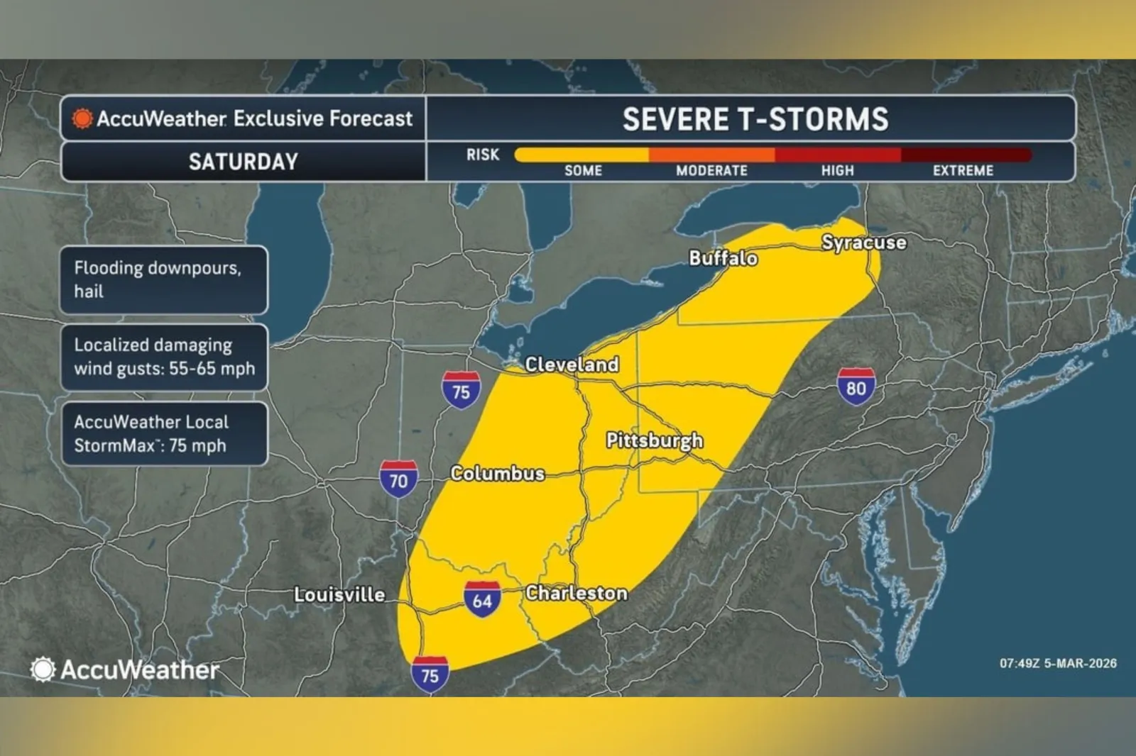
In an email sent to Newsweek on Thursday, forecasters at AccuWeather said that severe storms are expected Saturday from southern Texas through western Tennessee and into northwest Alabama, with another area of risk stretching from the eastern Ohio Valley into parts of western and northern Pennsylvania and western New York. Large hail, strong wind gusts, and flash flooding remain the primary concerns, it said.
...
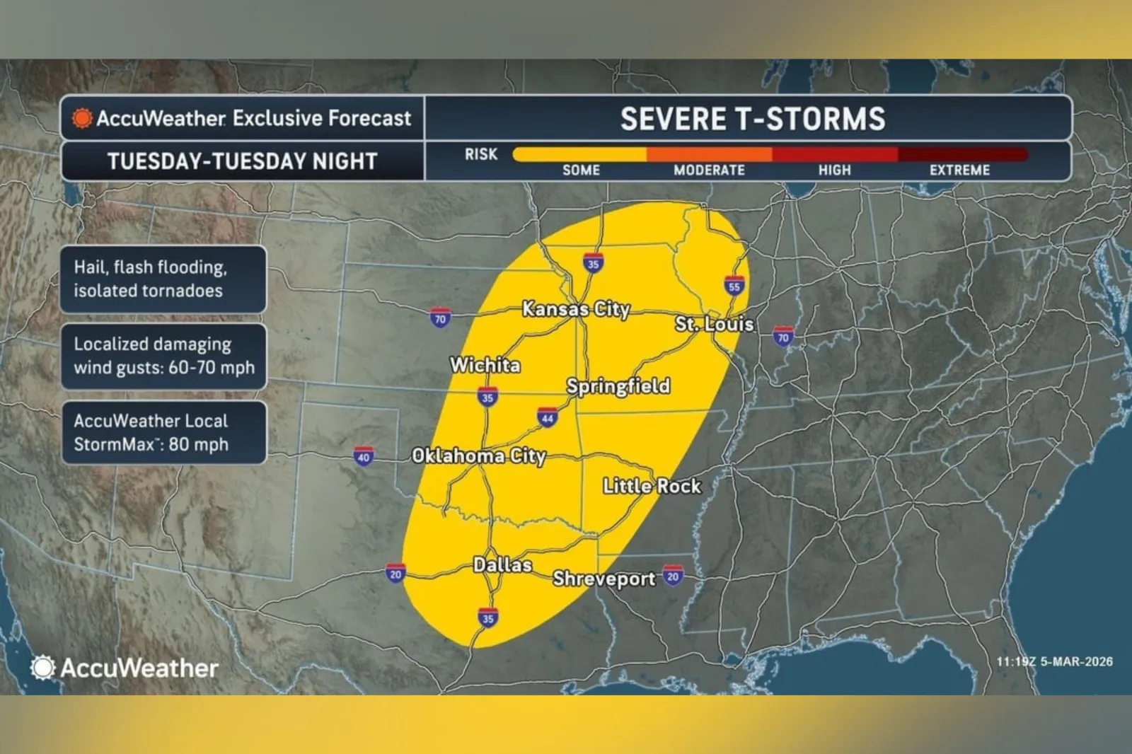
AccuWeather added that starting Tuesday next week, the threat for severe weather is expected to rise and may develop into a more substantial outbreak through Wednesday night as a strong storm system and cold front sweep across the area, with the possibility for several tornadoes to form during this window.
...
“Spring has arrived in the southern Plains with several days of severe weather threats. Friday is expected to be the most impactful day, said AccuWeather chief on-air meteorologist Bernie Rayno.
“One of the main ingredients for severe weather is wind. We will have strong winds in the lower and middle parts of the atmosphere, and they will strengthen Friday, adding extra energy into the equation.”
View 0 Comments
Submit Correction
View Editorial & AI Guidelines