10
Loading video...

By Melissa Fleur Afshar
Reporter
0
Share
Newsweek is a Trust Project member
See more of our trusted coverage when you search.Prefer Newsweek on Googleto see more of our trusted coverage when you search.
NASA's advanced seafloor mapping technology has revealed what is hidden beneath Earth's oceans.
The findings offer an insight into how underwater navigation can be improved.
The data comes from the Surface Water and Ocean Topography (SWOT) satellite, and was examined by a NASA-supported team tasked with improving our understanding of the underwater terrain that covers nearly three-quarters of the Earth's surface.
Read More on Science
Despite how oceans cover nearly three quarters of the Earth's surface, only about a quarter of the ocean floor had ever been surveyed directly.
The maps from SWOT—a collaboration between NASA and the French space agency—provide a more comprehensive view of seafloor structures such as abyssal hills and seamounts which shape ocean currents and marine ecosystems.
At the same time, the images can help scientists better understand geological process like plate tectonics.
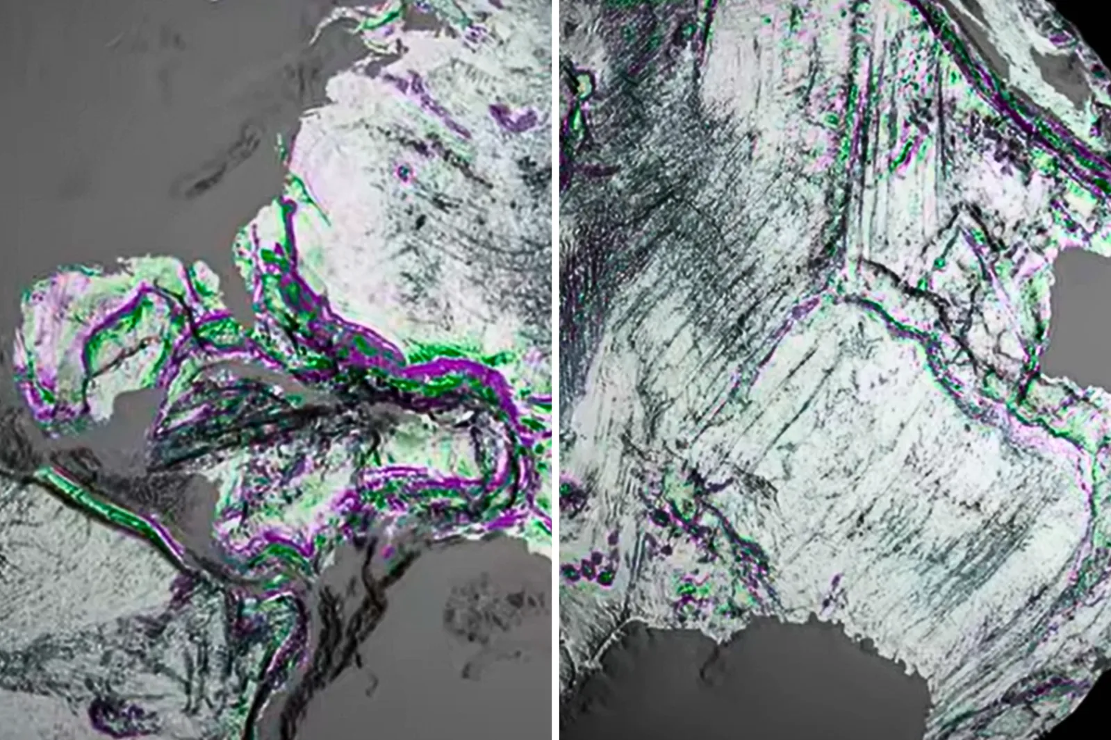
...
Seamounts are underwater mountains that rise hundreds or thousands of feet from the seafloor and can provide a vital habitat for marine life, while abyssal hills are smaller, underwater mounds.
SWOT is sensitive enough to pick up on minute differences with centimeter-level accuracy and can covers 90 percent of the globe every 21 days.
Geophysicist David Sandwell of the Scripps Institution of Oceanography and his colleagues used a year's worth of SWOT data to better understand seamounts, abyssal hills and underwater continental margins where continental crust meets oceanic crust.
Unlike previous satellites that could only detect seamounts more than a kilometer tall, SWOT can spot features less than half that height—potentially doubling the known number of underwater mountains from 44,000 to 100,000.
Why This Matters
Accurate maps of the ocean floor are not just useful for scientific curiosity. They are vital for submarine navigation, the laying of undersea cables, and for understanding ocean circulation and tides. These currents transport heat, affecting ecosystems from the sea surface to the abyss, and this new data can increase our knowledge into them.
"The SWOT satellite was a huge jump in our ability to map the seafloor," Sandwell said in a statement.
The researchers are now focused on calculating the depth of features captured in the SWOT data.
The satellite's ability to detect slight gravitational differences at the ocean surface is helping to fill in a planetary puzzle, and provide more insight into the history of the Earth and how we can stay safe while exploring its oceans.
Do you have a tip on a science story that Newsweek should be covering? Do you have a question about stars? Let us know via science@newsweek.com.
View 0 Comments
Submit Correction
View Editorial & AI Guidelines