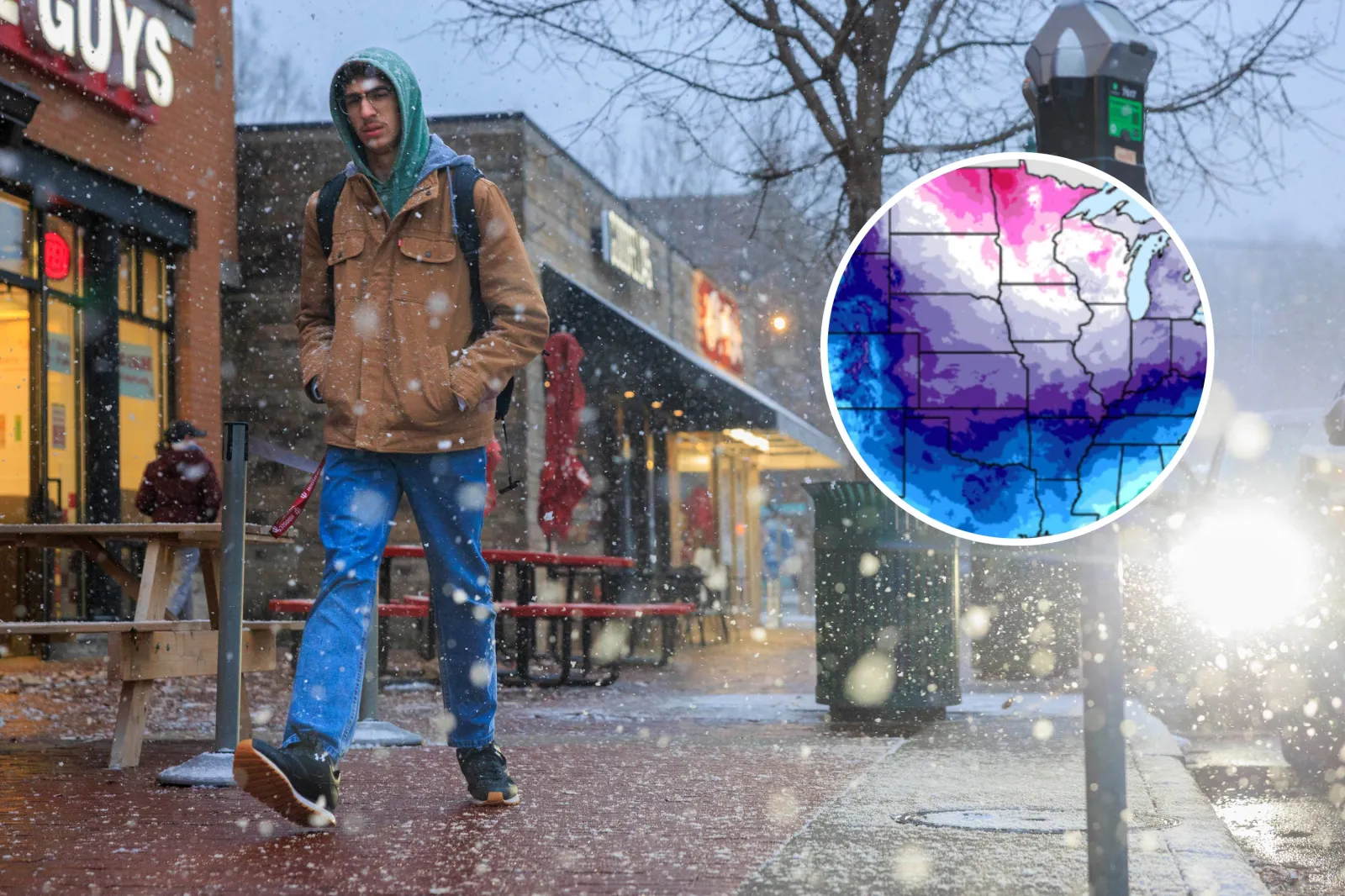
Jeremy Hogan/The Bloomingtonian/Weather Prediction Center

By Joe Edwards
Reporter
0
Share
Newsweek is a Trust Project member
See more of our trusted coverage when you search.Prefer Newsweek on Googleto see more of our trusted coverage when you search.
Bitter cold is expected to move from the north‑central United States into the Northeast by Friday, with the chill possibly pushing south from the southern Plains toward the Mid‑Atlantic, according to forecasters.
“Bitter cold could linger through the end of the month,” the National Weather Service (NWS) Weather Prediction Center (WPC) warned in an update on Monday.
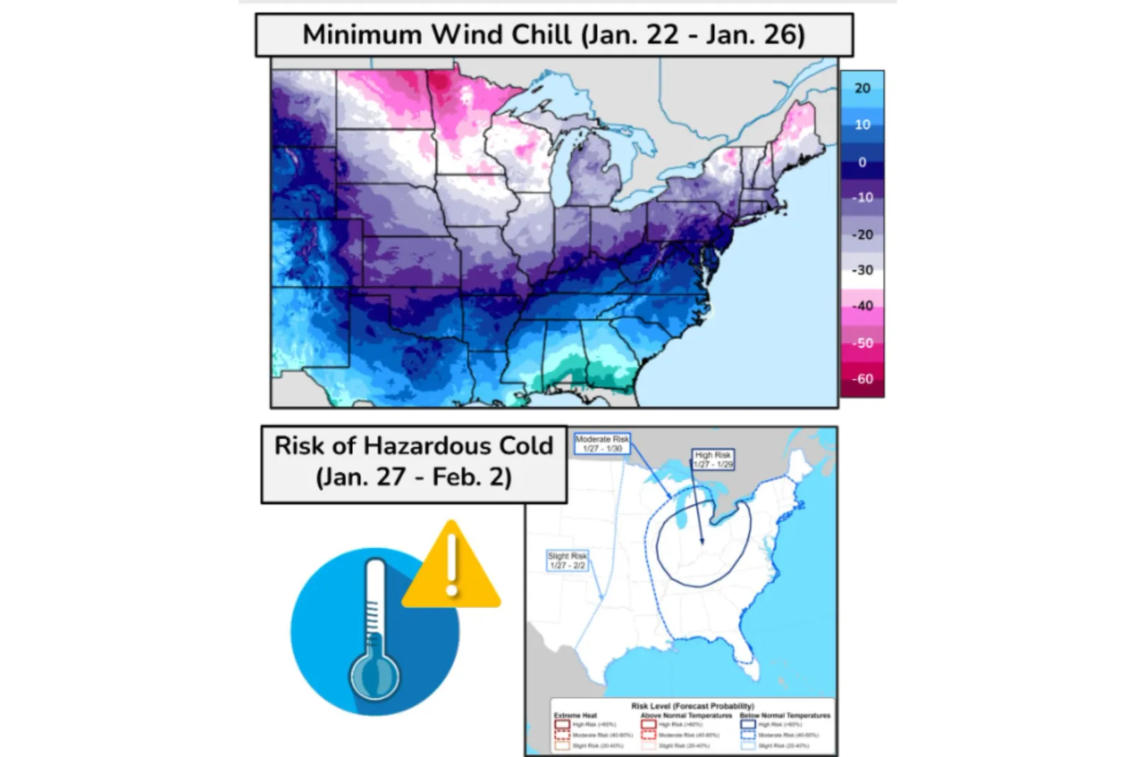
According to the agency, a surge of arctic air with “very cold” temperatures is set to sweep into the north‑central U.S. on Thursday, then stretch across the northern Plains, Midwest, and Great Lakes by Friday. “Dangerous” wind chills dipping into the -50s are possible in parts of the Upper Midwest, it said.
Read More on News
“Frigid” sub‑zero and single‑digit temperatures are expected to push into the Northeast and Ohio Valley Friday night and continue through the weekend. This intense cold could also reach the southern Plains and Mid‑South, though confidence in that outlook is lower, according to the WPC.
...
The Ohio Valley and Central Appalachians are at a high risk of experiencing greatly below-average temperatures from January 27 to 29, it added.
“These wind chills will post a life-threatening risk of hypothermia and frostbite to exposed skin,” the agency warned.
Additionally, the WPC said on Monday that a major winter storm is becoming increasingly likely later this week. “Significant” snow and ice could span from the Southern Plains on Friday to the Mid-Atlantic by the weekend, it said.
Heavy snow could lead to travel disruptions north of the storm track while an icy mix of freezing rain and sleet is probable to its south, the WPC said.
“Uncertainty remains regarding the location and magnitude of this winter storm’s various components,” it said in an update on Tuesday.
The forecasts come after meteorologists previously said the polar vortex is expected to unleash waves of icy air across parts of the U.S. through January.
What Is a Polar Vortex?
A polar vortex is a large area of low pressure and frigid air surrounding each of Earth’s poles. It is a year-round feature, though it weakens in summer and intensifies in winter.
The word "vortex" refers to the counterclockwise circulation that helps confine this cold air near the poles. In many northern hemisphere winters, the polar vortex can stretch southward, allowing cold air to spill down with the jet stream.
This is a fairly common winter pattern and is often linked to major Arctic cold outbreaks in the U.S., the NWS said.
View 0 Comments
Submit Correction
View Editorial & AI Guidelines