
...

By Amanda Greenwood
Associate News Editor
0
Share
Newsweek is a Trust Project member
See more of our trusted coverage when you search.Prefer Newsweek on Googleto see more of our trusted coverage when you search.
Satellite imagery has revealed the scale of destruction left behind by two massive wildfires burning across southern Georgia, as firefighters continue to battle blazes fueled by extreme drought, lingering storm debris, and persistent dry winds.
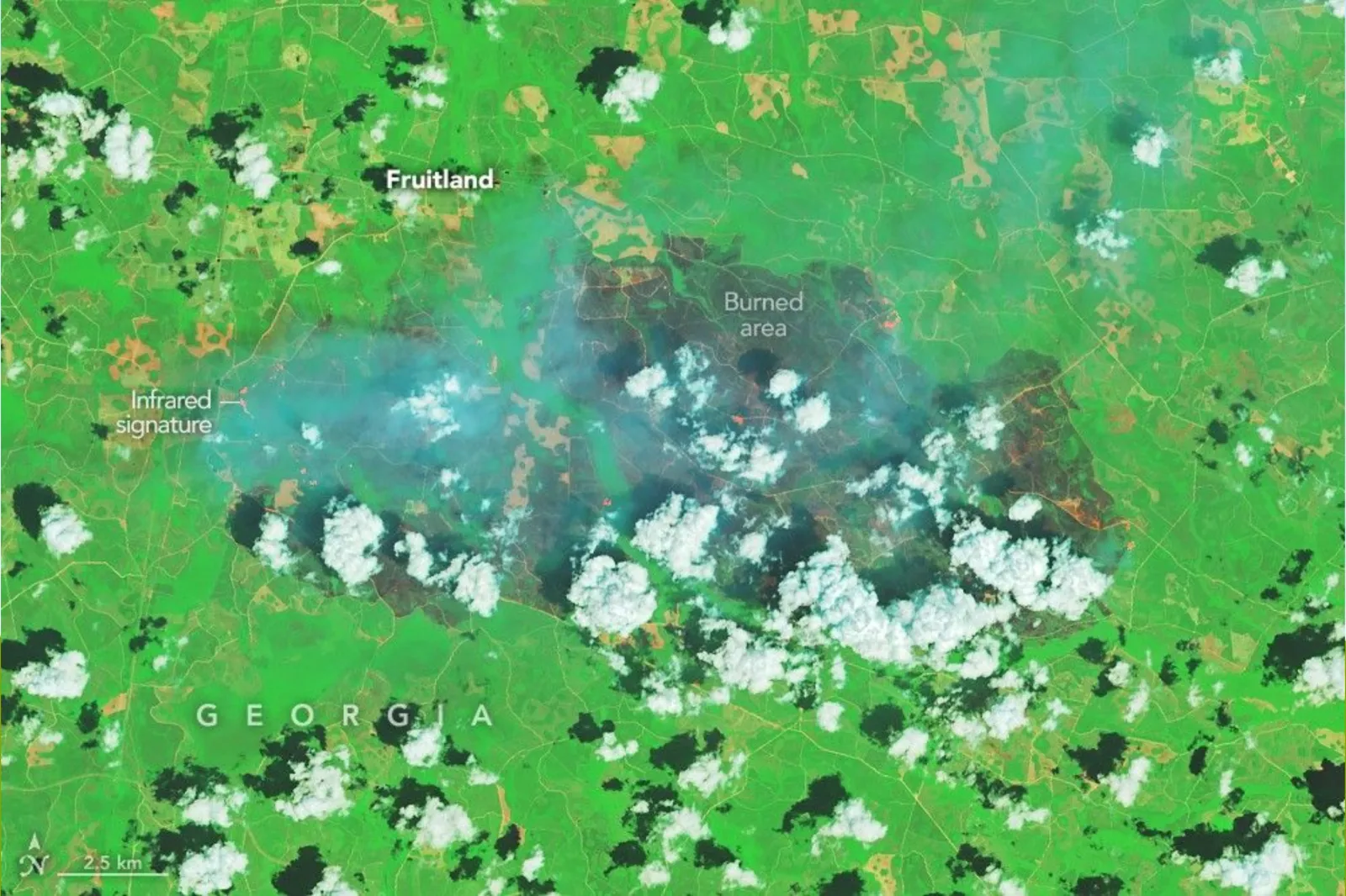
According to NASA’s Earth Observatory, the Pineland Road Fire and the Highway 82 Fire have burned more than 50,000 acres combined since igniting earlier in April, scorching forests, residential areas, and rural communities in parts of Brantley and Clinch counties.
Images captured by NASA’s Landsat 8 satellite show extensive burn scars near the towns of Atkinson and Fruitland, along with active fire fronts visible from space.
Read More on Weather
Drought and Storm Debris Helped Fires Spread
NASA scientists say the fires were intensified by an extreme drought that has gripped much of the Southeast for months, leaving landscapes unusually dry and highly flammable.
Forestry officials cited by NASA also pointed to debris left behind by Hurricane Helene in September 2024, including fallen trees and limbs, which provided abundant fuel and helped the fires spread rapidly once ignited.
The combination of prolonged dry conditions, gusty winds, and storm debris created a volatile fire environment across southern Georgia throughout April.
Human‑Caused Ignitions Sparked the Blazes
Both major fires were human‑caused, according to officials from the Georgia Forestry Commission. The Highway 82 Fire began on April 18 after sparks from a welding operation, while the Pineland Road Fire ignited several days later when a Mylar balloon struck power lines.
Containment remained limited as of April 28. At that time, the Pineland Road Fire was 23 percent contained, while the Highway 82 Fire was 32 percent contained. Hundreds of firefighters were deployed on the ground and by aircraft to strengthen fire lines.

...
...
Historic Losses for Georgia Communities
The fires have already inflicted historic damage. More than 120 homes were destroyed, marking the highest number of homes lost to wildfires in Georgia’s history, according to Governor Brian Kemp.
Authorities have warned that even as containment improves, wildfire conditions can change quickly if dry weather returns or winds increase.
Additional Fires Continue to Emerge
Beyond the two largest blazes, fire activity has continued elsewhere in the state. The Georgia Forestry Commission reported responding to eight new wildfires on April 29, burning an additional 2.8 acres statewide, not including the Pineland Road and Highway 82 fires.
Both major fires remain active, with crews continuing to fortify containment lines as conditions evolve.
Officials have urged residents to avoid active fire zones, refrain from flying drones that could interfere with firefighting aircraft, drive cautiously near smoke‑affected roadways, and monitor local alerts for road closures or evacuation notices.
Emergency Medical Aid Deployed
As the fires strain local infrastructure, humanitarian aid organization Direct Relief announced it has committed $25,000 in emergency funding and mobilized medical aid to support health care providers serving fire‑impacted communities across Georgia. The nonprofit has shipped out respirators to help protect residents and health workers from smoke and is offering access to its medical inventory for clinics statewide.
Direct Relief also provided an additional $25,000 in emergency operating funds to Coastal Community Health, a federally qualified health center in Brantley County whose facilities experienced smoke damage, operational disruptions, and staff displacement due to the fires.
The Outlook Remains Uncertain
While some progress has been made, officials caution that risks remain high. With large fires still active, drought impacts lingering, and thousands of acres already burned, Georgia is facing one of the most destructive wildfire episodes in its history, with recovery expected to extend long after the flames are contained.
View 0 Comments
Submit Correction
View Editorial & AI Guidelines