...

By Hollie Silverman
News Editor
0
Share
Newsweek is a Trust Project member
See more of our trusted coverage when you search.Prefer Newsweek on Googleto see more of our trusted coverage when you search.
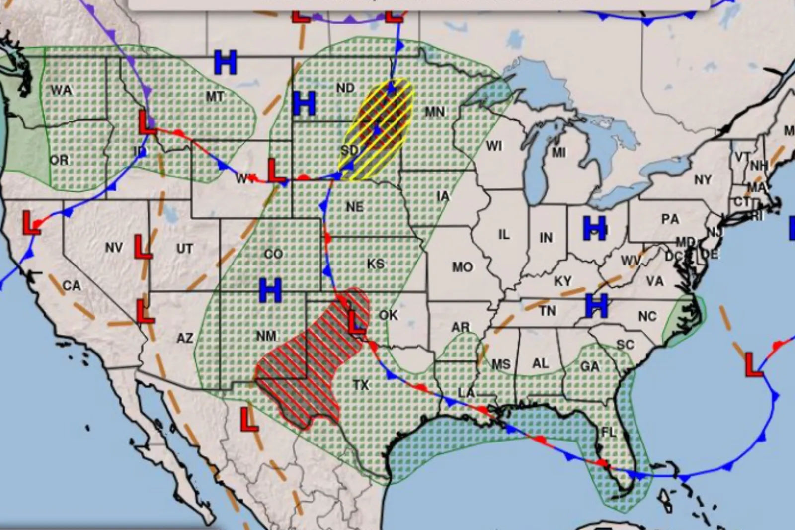
A widespread severe weather system is sweeping across the central United States, putting more than 25 million people at risk of damaging storms, large hail and flash flooding as the threat shifts eastward through the Plains this week.
Forecasters warn that the multi-day event could disrupt travel and daily life across a broad swath of the country, with hazards ranging from destructive winds to isolated tornadoes, according to the National Weather Service (NWS).
The system is unfolding during an already-active severe weather season that has seen unusually high tornado activity in parts of the Midwest.
Read More on News
...
What to Know About Severe Weather System
A highly active weather pattern is driving repeated rounds of storms across the Plains, fueled by a dip in the jet stream, warm temperatures and moisture streaming north from the Gulf.
These ingredients are combining to produce severe thunderstorms capable of large hail, damaging wind gusts and isolated tornadoes while increasing the risk of flash flooding from repeated downpours.
The system is not a single storm but part of a broader pattern expected to persist for days, with disturbances moving east and triggering new rounds of storms each afternoon and evening.
Which States Will Get Severe Weather Next?
Forecasters say the threat will continue across much of the Plains before gradually shifting east into parts of the Midwest.
The highest risk extends from New Mexico and Texas north through the Dakotas, with storm activity expected to expand into states including Nebraska, Kansas, Iowa, Minnesota and Missouri as the system tracks eastward.
By later in the week, storms are expected to bring severe weather risks into additional Midwest areas as the front stalls and interacts with warm, unstable air.
"Storm Prediction Center [SPC] also highlights that these storms may become strong to severe and produce large hail and severe wind gust, leading to Slight Risk [level 2/5] of severe thunderstorms across parts of the Northern Plains into the Upper Mississippi Valley," a forecast from the NWS said.
"Training convection and high rainfall rates may also lead to localized flooding concerns, which is highlighted through Weather Prediction Center [WPC] excessive rainfall outlook with a Slight Risk [level 2/4] over west Texas into New Mexico, as well as the eastern Dakotas."
Where Has Severe Weather Already Hit?
On Monday, Severe storms erupted across Colorado, including the Denver metro area, where hail as large as golf balls fell and forced drivers to stop along highways.
Storms expanded across the Plains on Tuesday, with severe thunderstorms reported from the Dakotas through Nebraska and into surrounding states, continuing the multi-day outbreak.
Additional rounds of severe weather have continued across the central U.S., with storms redeveloping daily and spreading across a wide corridor in the Plains.
How to Prepare and Protect Yourself
Officials urge residents in the threat zone to stay alert as conditions can change quickly during severe weather events.
Large hail and damaging winds can develop with little warning, and flash flooding can occur rapidly in areas of repeated rainfall.
Safety recommendations include:
- Monitor forecasts and local alerts throughout the day
- Move indoors to a sturdy building at the first sign of severe weather
- Avoid windows during hail or high winds
- Never attempt to drive through flooded roadways
- Identify a safe shelter location ahead of potential warnings
View 0 Comments
Submit Correction
View Editorial & AI Guidelines