Newsweek/Map image for thumbnail

By Joe Edwards
Reporter
0
Share
Newsweek is a Trust Project member
See more of our trusted coverage when you search.Prefer Newsweek on Googleto see more of our trusted coverage when you search.
Parts of Texas were under extreme cold watch from the National Weather Service (NWS) on Monday morning, the service warning that "dangerously cold" wind chills will hit the state in the coming days.
Why It Matters
The country has already faced multiple bouts of challenging weather this season.
Read More on News
Freezing temperatures can pose health risks, particularly for vulnerable groups such as infants and older adults.
What To Know
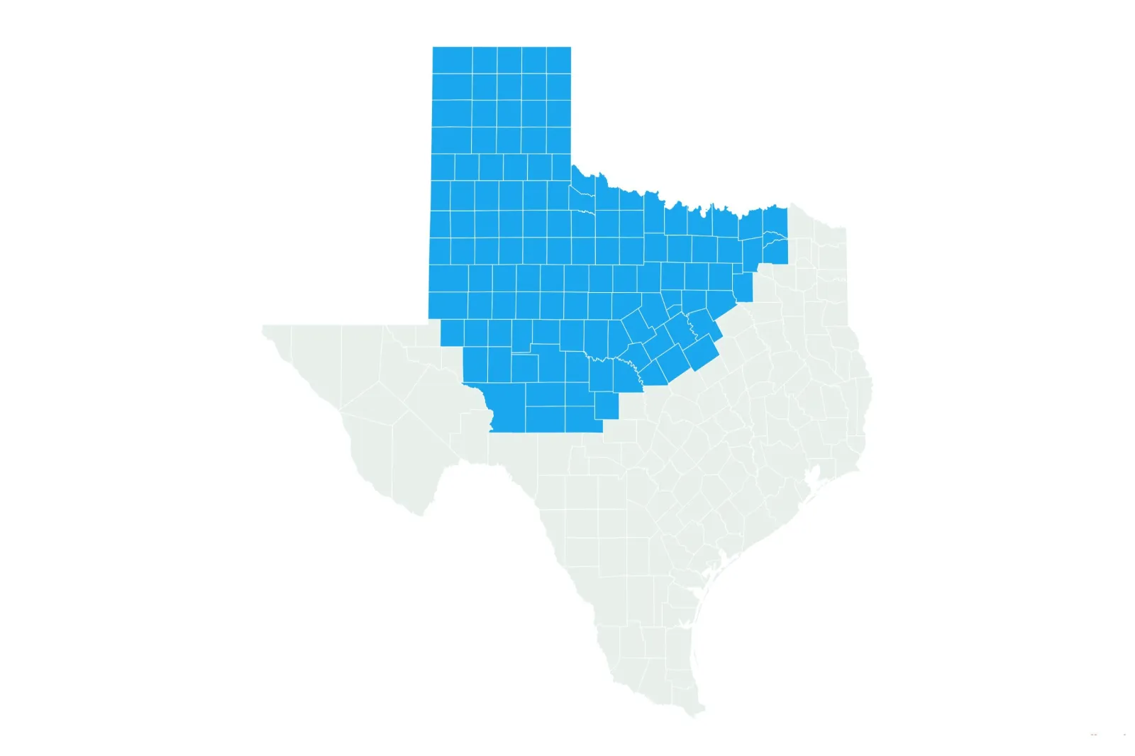
More than 120 counties across the Texas Panhandle, North Texas, and Central Texas were under extreme cold watch—which, according to the NWS, means "prolonged periods of very cold temperatures are expected"—as of Monday morning.
"Dangerously cold" wind chills as low as 25 below zero could be possible in parts of the Texas Panhandle, the NWS said, warning of hypothermia risks if precautions are not taken.
"Frostbite and hypothermia will occur if unprotected skin is exposed to these temperatures," the service said.
"An extended period of freezing temperatures could cause ruptured water pipes."
Those under extreme cold watch should adjust plans to avoid being outside during the coldest parts of the day, the NWS advises on its website.
It also advised Texans to dress in layers, including hats, face masks, and gloves, if they must venture outdoors.
"Keep pets indoors as much as possible," it said, adding that residents should "make sure outdoor animals have a warm, dry shelter, food, and unfrozen water."
A powerful high-pressure system is pushing Arctic air into the southern Plains as a weather system moves out Tuesday night, AccuWeather meteorologist Jacob Hinson told Newsweek.
The northern Panhandle is expected to experience the coldest temperatures that night, while areas further south and east will see their lowest readings on Wednesday night, he said.
"Even places further south can experience low temperatures that are 10-15 degrees below historical average," said Hinson.
What People Are Saying
AccuWeather meteorologist Jacob Hinson told Newsweek: "Snowfall chances for most of the state are minimal, but the very northern tip of the panhandle could see a coating to an inch through Tuesday night. Any snow flurries that make their way further south in the panhandle won't accumulate more than a coating.
"The rest of the state should dodge this round of snow. The other impactful weather will be some freezing rain and drizzle near the eastern panhandle and northern prairie through Dallas on Tuesday night."
NWS Fort Worth-Dallas said on X on Monday: "Our next arctic blast will arrive Tue! Light freezing rain/drizzle may develop after sunset on Tue. Minimal icing is possible on elevated surfaces. Dangerously cold temperatures/wind chills will settle in Wed AM and linger through Thursday afternoon. Don't delay, prepare today!"
NWS Amarillo said on X, Sunday: "While most attention is on the incoming cold air, there will also be chances for snow. There's still a fair bit of uncertainty on amounts, but the NE Panhandles have best chances for 1." Much like last Wed, it won't take much moisture to get light snow as the front moves in."
What Happens Next
At the time of writing the NWS' extreme cold warning were in place from Tuesday evening through Thursday morning.
"Thankfully, temperatures warm up a bit by Saturday, then correct to around or above historical averages by Sunday in the northern part of the state" Hinson said.
"These changes trickle down to the southern part of the state on Monday."
The NWS issues forecasts updates on its website regularly.
Do you have a story we should be covering? Do you have any questions about this article? Contact LiveNews@newsweek.com
View 0 Comments
Submit Correction
View Editorial & AI Guidelines