...

By Sam Stevenson
Associate News Editor
0
Share
Newsweek is a Trust Project member
See more of our trusted coverage when you search.Prefer Newsweek on Googleto see more of our trusted coverage when you search.
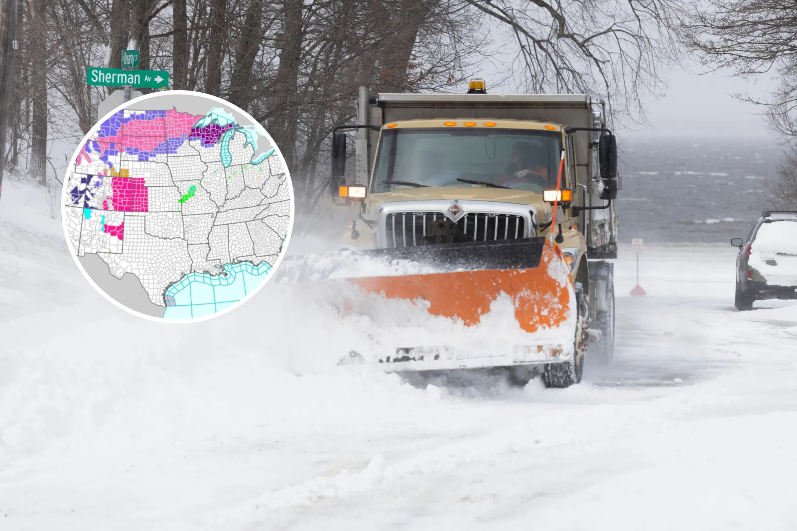
A sprawling winter storm is triggering warnings across the U.S., with forecasters cautioning that conditions will be “extremely dangerous” as snow totals climb as high as two feet in some areas.
Winter storm warnings are now in effect across seven states, stretching from the Northern Plains to New England.
North Dakota, South Dakota, Minnesota, Montana, Wyoming, Michigan and Maine are all impacted.
Read More on Weather
National Weather Service (NWS) forecasters say the most intense impacts will come from heavy snow—up to 1 to 2 feet in the Rockies—along with ice, blowing snow, power outages and travel that could quickly become hazardous.
The system is unfolding as cold air clashes with lingering moisture, producing a mix of snow, sleet and freezing rain over several days.
...
Mountain West Braces for Feet of Snow and Avalanche Risk
The most severe conditions are expected in the Rocky Mountains of Montana and Wyoming, where warnings were issued Thursday evening and remain in effect through Friday evening, local time.
In the Absaroka/Beartooth Mountains and Crazy Mountains in Montana, forecasters warned of 1 to 2 feet of snow, with north- and west-facing slopes potentially exceeding two feet.
Winds could gust up to 45 mph, increasing avalanche danger and making backcountry travel hazardous.
Nearby, the Pryor and Northern Bighorn Mountains of Montana and Wyoming face similar totals, with an NWS warning noting that “the highest peaks of the northern Bighorns and Pryors could see snow totals in excess of 24 inches.”
Travel on Highway 14 through Burgess Junction could become “nearly impossible” due to blowing and drifting snow.
Wyoming’s Bighorn Mountains, Tetons, Wind River Mountains, and Yellowstone National Park are also under winter storm warnings through 6 p.m. MDT Friday.
Snow totals range from 12 to 20 inches, with localized amounts up to 24 inches along western slopes.
Wind gusts of 45 to 55 mph could severely reduce visibility on mountain passes.
Forecasters repeatedly urged caution, warning: “Do not get caught unprepared in the high country.”
Heavy Snow and Blowing Winds Sweep the Northern Plains
Farther east, a wide swath of the Dakotas and Minnesota is bracing for significant snowfall and difficult travel through the weekend.
In North Dakota, winter storm warnings were issued early Friday morning and extend through Saturday afternoon.
Much of the state, including southwest, south central and southeast regions, is expected to receive 6 to 12 inches of snow, with wind gusts up to 35 mph.
Officials warned that travel “may become very difficult” during both morning and evening commutes.
Across South Dakota, warnings cover large portions of the state through Saturday midday or evening, depending on location.
Forecast snow totals range from 7 to 14 inches in north-central areas, with ice accumulations up to two-tenths of an inch.
Some zones may see slightly lower snow totals but more significant icing, raising the risk of power outages and tree damage.
In Minnesota, multiple NWS offices warned of 7 to 13 inches of snow across central, west-central and northwest regions, with the heaviest snow expected from Friday afternoon through early Sunday.
Blowing snow could make travel “very difficult to impossible,” especially as warmer temperatures cause snow to stick to road surfaces.
Ice and Mixed Precipitation Threaten Upper Midwest
While snow dominates farther west, parts of the Upper Midwest face a dangerous mix of precipitation.
In Michigan’s Upper Peninsula, winter storm and ice storm warnings were issued early Friday and extend into Saturday afternoon.
Forecasters expect sleet accumulations of one to two inches and ice accumulations up to four-tenths of an inch, with gusts reaching 40 mph.
Power outages and tree damage are considered likely in several counties.
One warning cautioned residents to prepare accordingly, noting that travel will be difficult during both the morning and evening commutes.
Maine Sees Snow, Sleet and Ice
In northern Maine, Winter Storm Warnings remain in effect through Friday afternoon for Aroostook County. Forecasts call for 2 to 5 inches of snow, up to 1 inch of sleet, and ice accumulations around one-tenth of an inch.
Roads, bridges and overpasses are expected to become slick, with officials urging drivers to plan for hazardous conditions during peak commute hours.
Why Officials Are Urging Caution
Across regions, the NWS emphasized the seriousness of the storm’s impacts.
“A winter storm warning means significant amounts of snow, sleet, and ice will make travel extremely dangerous,” one advisory stated.
Repeated guidance urges people to avoid unnecessary travel, carry emergency supplies if driving cannot be postponed, and check local road conditions through 511 services.
In mountainous areas, forecasters stressed that outdoor recreation could quickly become life-threatening due to exposure, disorientation, and avalanche danger.
As the storm continues to unfold through Friday and Saturday, officials warned that conditions could deteriorate rapidly, especially where snow, wind and ice overlap—making preparation and caution critical across all affected states.
View 0 Comments
Submit Correction
View Editorial & AI Guidelines