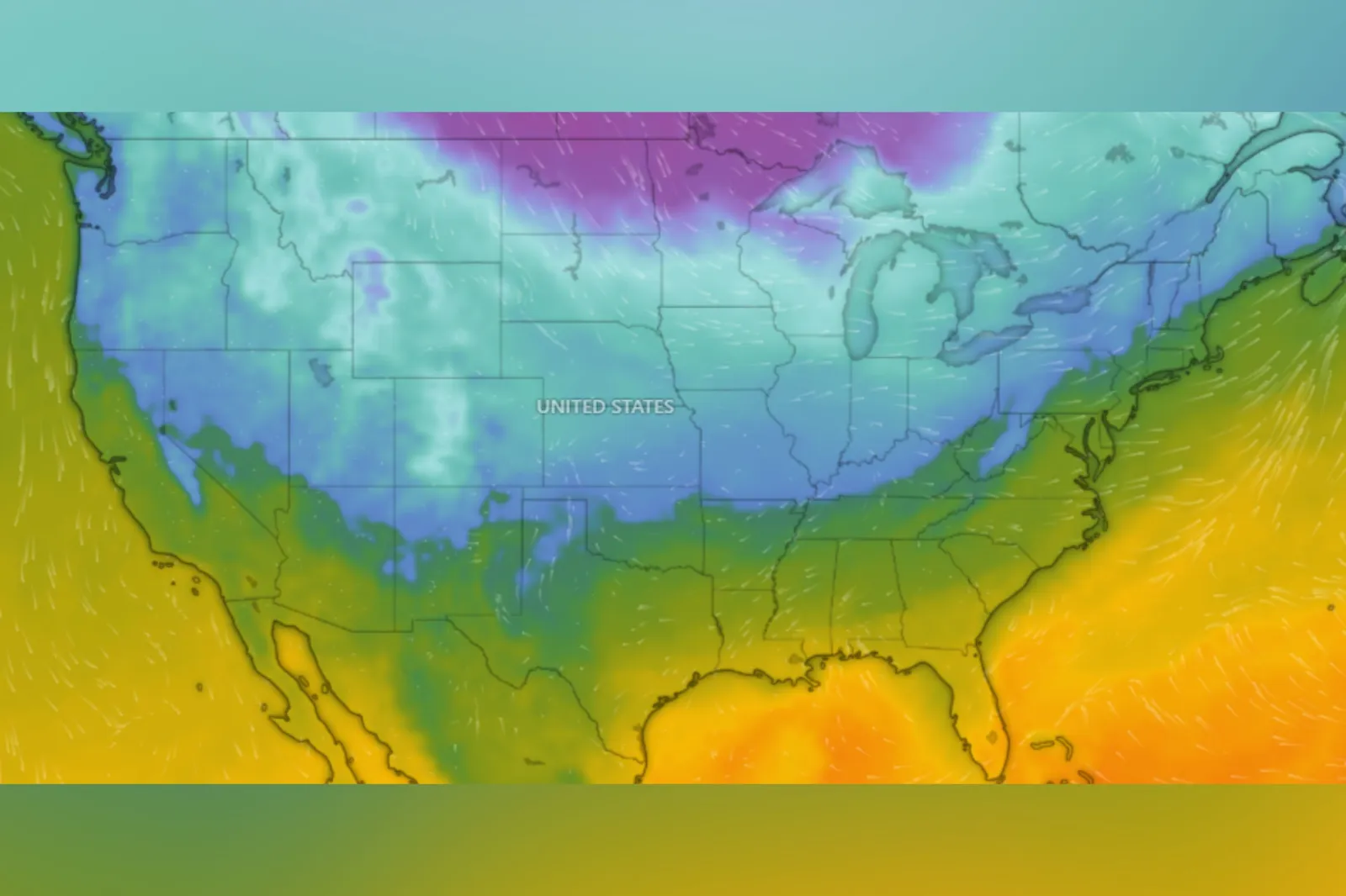
Windy.com

By Joe Edwards
Reporter
0
Share
Newsweek is a Trust Project member
See more of our trusted coverage when you search.Prefer Newsweek on Googleto see more of our trusted coverage when you search.
Live tracker maps show current conditions across the U.S., as a powerful winter storm is expected to sweep across the country late this week.
List of Winter Storm Watches
As of reporting, the National Weather Service (NWS) has published winter storm watches—issued “when there is the potential for significant and hazardous winter weather within 48 hours”—across parts or all of the following states:
Read More on News
- Arizona
- New Mexico
- Texas
- Oklahoma
- Arkansas
- Louisiana
- Missouri
- Mississippi
- Alabama
- Tennessee
- Georgia
- Illinois
- Indiana
- North Carolina
- South Carolina
- Virginia
- Kentucky
- Ohio
- West Virginia
- Maryland
- Delaware
- Pennsylvania
- New York
Winter Storm Map
Temperature
New Snow
Snow Depth
Icing Severity
Full Winter Storm Forecast
In an update on Thursday morning, the Weather Prediction Center said the “long-duration” winter storm is expected to deliver widespread heavy snow, sleet, and freezing rain from the Southern Rockies and Plains into the Mid-South starting Friday, then advancing into the Mid-Atlantic and New England this weekend, with effects possibly lasting into Monday in New England. “Extremely cold” air behind the system will extend hazardous travel and infrastructure impacts, it said.
Heavy snowfall is expected across a broad stretch from the Southern Rockies and Plains through the Mid-Atlantic and into the Northeast. Totals over 12 inches are increasingly probable in localized areas and widespread travel disruptions are likely, according to the agency.
“Widespread” freezing rain and sleet are forecast to affect parts of the Southern Plains, Lower Mississippi Valley, Tennessee Valley, the Southeast, and southern Virginia. Significant ice buildup is possible, bringing risks of long-lasting power outages, major tree damage, and severely hazardous or even impassable travel conditions, it said.
“Confidence is high in a significant and impactful winter storm, but uncertainty remains in the exact storm track, timing, and placement of the heaviest snow and ice,” the agency said. “Even small shifts could lead to large changes in local impacts. Preparations should be completed as soon as possible, and forecasts closely monitored for updates.”
These uncertainties "are still there" but are "narrowing as we get closer to the onset of the event," Brian Hurley, a senior forecaster for NOAA's Weather Prediction Center told Newsweek Thursday.
Winter Storm Name
While the storm has not been designated an official name, The Weather Channel has used its own list of names for storms since 2012, per The New York Times.
The outlet has named this system Winter Storm Fern.
How Bad Is The Winter Storm Going To Be
“This storm is a rare, high-impact storm for the South. Heavy ice accumulations followed by a deep freeze can lock in dangerous conditions long after the storm passes,” AccuWeather chief meteorologist Jonathan Porter said in an email sent to Newsweek Thursday.
“This storm may bring vastly different impacts across short distances. Changes in elevation, temperature and the storm track could be the difference between snow, ice, sleet, freezing rain or rain in the span of just 50 miles. This is a slower-moving storm compared to others we have seen in recent weeks. The freezing rain, ice and snow impacts could last 24 to 36 hours in some places.”
Porter added: “Snow and ice from this storm will spread across a vast region that rarely experiences winter weather of this magnitude. Airports, interstates and major rail corridors could face multi-day shutdowns, creating cascading disruptions to travel, commerce and supply chains well beyond the hardest hit areas.”
View 0 Comments
Submit Correction
View Editorial & AI Guidelines