...

By Sam Stevenson
Associate News Editor
0
Share
Newsweek is a Trust Project member
See more of our trusted coverage when you search.Prefer Newsweek on Googleto see more of our trusted coverage when you search.
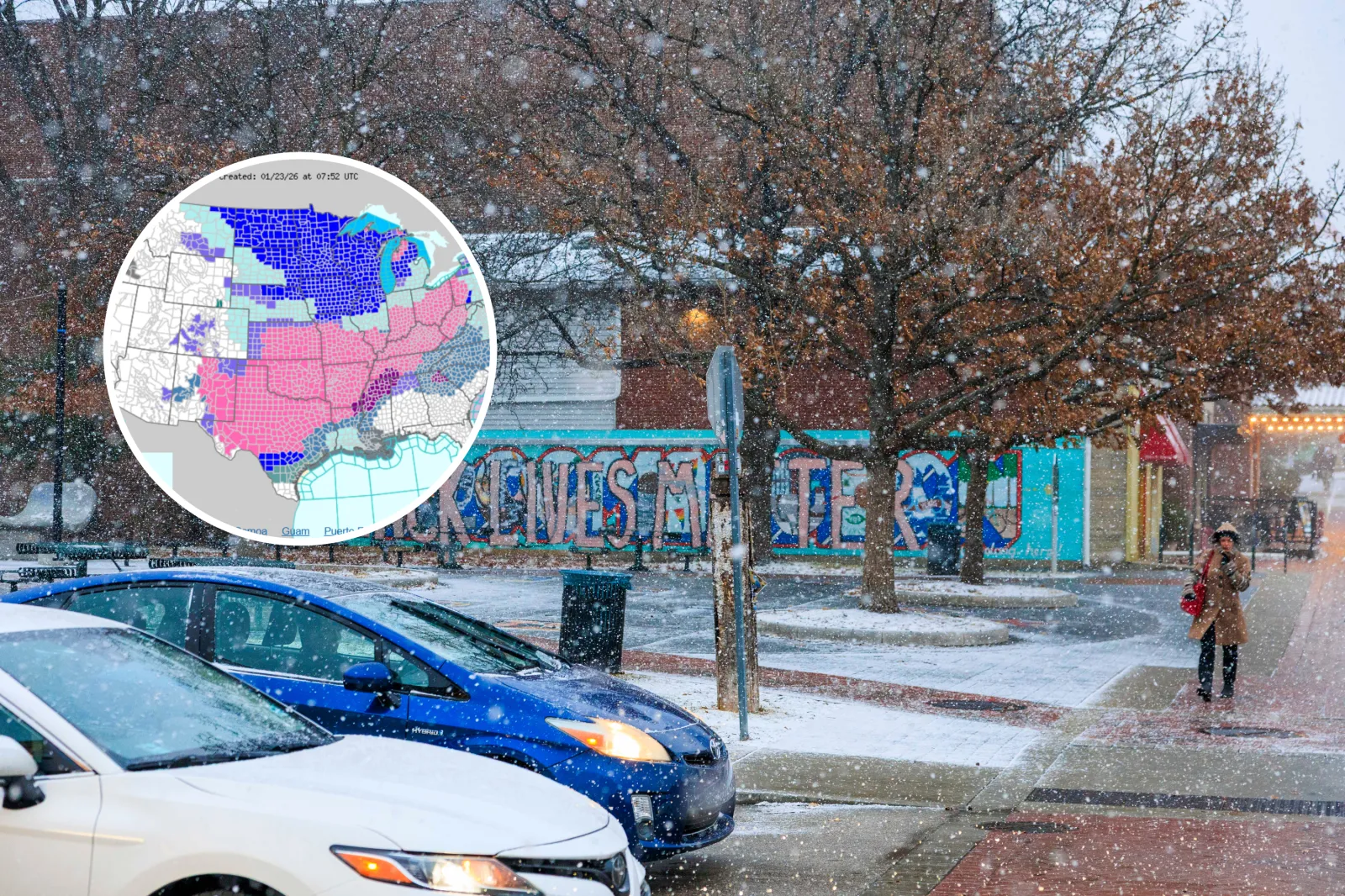
A sprawling winter storm has triggered official National Weather Service (NWS) warnings across a wide stretch of the country, bringing heavy snowfall totals of up to 17 inches.
Significant icing and dangerous cold are also expected from the Southern Plains to the Great Lakes and Appalachians.
Some regions are bracing for more than a foot of snowfall, while others face enough ice to trigger widespread outages and nearly impossible travel through Sunday and into Monday's commute.
Read More on News
...
Pennsylvania
Warnings remain in effect through Monday morning across western and northwestern Pennsylvania, where 10 to 17 inches of snow are expected—the highest totals in this storm. Travel could become extremely difficult on Sunday.
West Virginia
Large portions of West Virginia, including higher elevations, remain under warnings through early Monday. Snow and sleet totals could reach 14 inches in the mountains, while central counties face meaningful icing and dangerous road conditions.
Kansas
Warnings in Kansas run from Friday into Sunday as large portions of central, south‑central and southwest counties prepare for 5 to 10 inches of snow, with locally higher totals. Travel conditions are expected to deteriorate quickly once the storm intensifies Friday night.
The NWS said: "If you must travel, keep an extra flashlight, food, and water in your vehicle in case of an emergency. The latest road conditions for the state you are calling from can be obtained by calling 511."
Colorado
Colorado's warnings remain in effect through the weekend, with the eastern San Juan Mountains above 10,000 feet expecting 10 to 18 inches of snow and strong gusts as high as 35 mph.
Mountain passes may become difficult or impassable as blowing snow reduces visibility.
New Mexico
Much of central and eastern New Mexico—including stretches of Interstate 40—remains under warnings through early Sunday. Snowfall will range from 4 to 8 inches across lower elevations, climbing to as much as 16 inches in the high country, alongside dangerous wind chills.
The NWS said: "Travel will become very difficult to impossible for an extended period of time, most notably along I‑40 from Tijeras Canyon to the Texas border.
"The weight of accumulating snow will stress the power grid, potentially creating outages. An extended period of cold temperatures will increase the risk of frostbite and hypothermia."
Texas
Warnings stretch from Friday into Sunday across north, central and West Texas. A significant icing event could leave a quarter‑ to three-quarter‑inch of glaze, while areas farther west may pick up 4 to 10 inches of snow. Power outages and major travel disruptions are likely as the storm settles in.
"Roads, and especially bridges and overpasses, will likely become slick and hazardous," according to the NWS.
Oklahoma
Oklahoma's warnings extend through the weekend, with widespread snowfall of 6 inches or more and pockets of icing in southern counties. "Dangerously cold" wind chills are set to accompany the storm, making travel increasingly hazardous.
Arkansas
Warnings covering Arkansas last from Friday into Sunday. Northern counties are forecast to see 4 to 10 inches of snow, central areas may get a blend of sleet and snow, and the southern tier faces a substantial icing threat that could lead to prolonged outages.
The NWS said: "Expect power outages and tree damage due to the ice. Travel could be impossible. The hazardous conditions could impact the Friday evening commute."
Missouri
Missouri's warnings continue through Sunday as 6 to 12 inches of snow fall across central and southern counties, particularly along and south of I‑44. Subzero wind chills over the weekend may heighten risks for anyone on the roads.
Illinois
Southern and southwestern Illinois remain under warnings through the weekend, with 6 to 10 inches of snow expected. Rapid accumulation will likely make travel extremely difficult.
The NWS said: "Persons should consider delaying all travel. Motorists should use extreme caution if travel is absolutely necessary."
Indiana
Warnings in Indiana cover much of the weekend as east‑central and southeastern counties prepare for 8 to 12 inches of snow. Many areas may still be digging out on Monday morning.
Ohio
Ohio's warnings run from Saturday into early Monday, with 6 to 12 inches of snow expected depending on location. Bitter cold may linger behind the storm, keeping roads hazardous into next week.
Kentucky
Kentucky remains under warnings through Monday morning. Areas north of the parkways are forecast to receive 10 to 14 inches of snow, while southern counties face a messy mix of snow and ice that could cause outages and treacherous travel.
Tennessee
Warnings across middle and West Tennessee stretch into Sunday evening as 2 to 9 inches of snow and sleet combine with up to a quarter‑inch of ice. Tree damage, outages and impassable roads are likely.
Mississippi
Northern Mississippi is under warnings through Sunday, with 3 to 9 inches of snow and sleet expected. Light icing may add to hazardous conditions and scattered outages.
Michigan
Michigan's warnings continue into Friday afternoon as lake‑effect snow produces another 1 to 6 inches across northern lower Michigan and parts of the Upper Peninsula. Whiteout conditions may persist at times.
Virginia
Southwest Virginia remains under warnings through Monday morning as 3 to 8 inches of snow and sleet combine with significant icing. Tree damage and outages are expected where freezing rain becomes more persistent.
Louisiana
Northern Louisiana remains under warnings through midday Sunday, with up to 1 inch of ice possible. The combination of glaze and sleet may trigger widespread power outages and make travel extremely hazardous.
New York
The eastern Lake Ontario region stays under a winter storm warning into Friday evening before shifting to a watch for the next round of snow. Lake‑effect bands this weekend could add 8 to 16 inches, especially across the Tug Hill Plateau.
The NWS said: "For the Winter Storm Warning, heavy lake effect snow. Additional snow accumulations 8 to 16 inches in the most persistent bands. Winds gusting as high as 40 mph will produce blowing and drifting snow. For the Winter Storm Watch, heavy snow with significant accumulations likely."
View 0 Comments
Submit Correction
View Editorial & AI Guidelines